


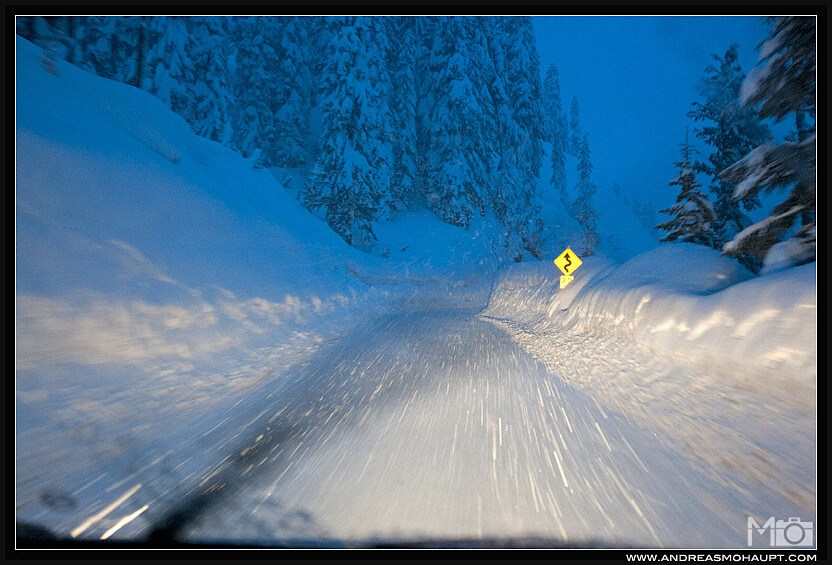
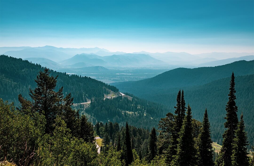
Before arriving to your favorite ski resort, the first major obstacle is the road to get there. For some, a flight or train ride will do the job, but most of the time, you’re destined for a road trip. So, how do the major mountain passes stack up? Which is the most dangerous? How about the most switchbacks? After a bit of research, we found out which ones are the most dangerous roads per mile in the US to your favorite ski area.
What’s The Ranking Criteria?
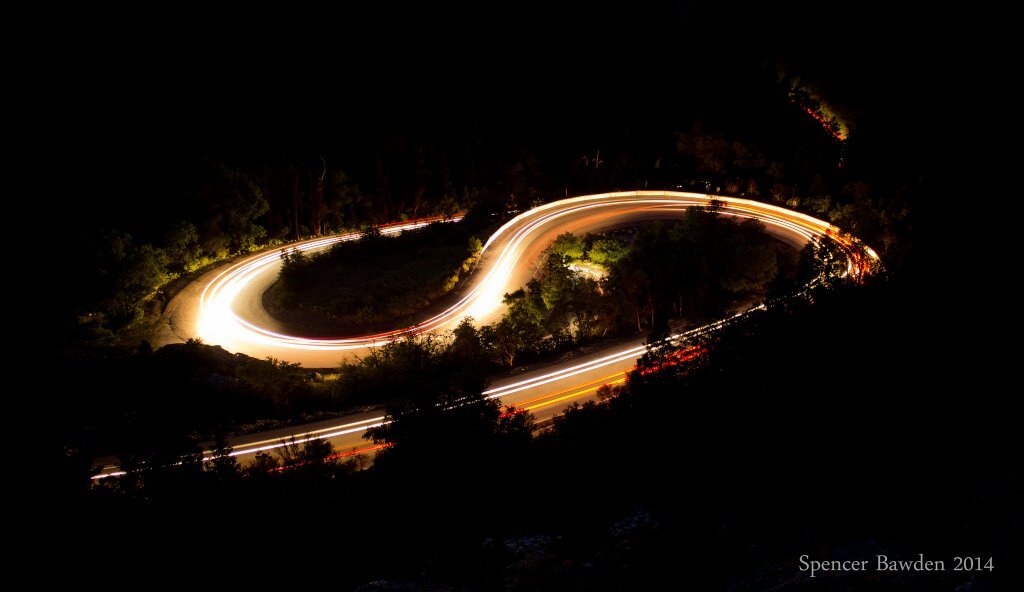
Switchbacks
This criteria was specifically weighted heavier than the rest of the characteristics. The curvier the road, the higher likelihood of sliding off it. Some mountain roads can reach upwards of 30 twists and turns, making it feel like you never drive straight. Both Mt. Rose Highway, NV and Red Mountain Pass, CO are windier than most, clocking in at 29 and 27 switchbacks respectively.
Season Snowfall Totals
No matter how dangerous overall the road is, high amounts of snowfall lead to slippery conditions and make your journey more treacherous.
Average Grade
The more continuous the incline or decline, the greater likelihood of traction issues. Over the entire mountain pass, the average grade is an important consideration for safety. Though a number like 5% may not sound like much to you, it can be a monster number to your tires. Big Cottonwood Canyon, UT, which accesses ski resorts like Brighton and Solitude, has the largest average grade at just over 5.8%.
Maximum Grade
In addition to the average gradient, how steep does the path get at any single point? Both Big Cottonwood Canyon, UT and Teton Pass, WY have sections over 10% in incline. Yikes! Not a lot of room for error on a pitch like that.
Elevation Gain
Who knew Isaac Newton was smart on treacherous mountain passes. The old saying “What goes up must come down” definitely applies to winter driving. The elevation gain is determined by subtracting the lowest driving elevation from the summit elevation. Again, Big Cottonwood Canyon, UT has one of the biggest elevation gains out of all the roads standing at 4,900 vertical feet.
Length
Besides how steep, it’s also important to know how long the road is. Are you going to be stuck on this road for 10 minutes or 3 hours? Rogers Pass, BC is the longest with multiple ascents & descents across the entire 49 mile stretch.
Summit Elevation
Not as significant but still a factor is the altitude of the summit. Just like humans, cars and trucks don’t run as well at high altitudes. Both the Colorado passes on this list stand head and shoulders above the rest at nearly 11,000 feet.
Additional Facts
Lastly, we took into consideration other factors such as guard rails/shoulders, car accidents per capita, and fatal accidents or car crashes.
Top Most Dangerous Roads In The US
#5 – Mt. Baker Highway, WA
Ski Resort: Mt. Baker Ski Resort
The Facts:
Switchbacks – 21
Annual Snowfall – 647″
Elevation Gain – 3,394′
Length – 21 mi
Starting out at nearly sea level, this road quickly rises up to its summit at Mt. Baker Ski Resort which is the snowiest resort in America. Even though the pitch isn’t very steep, it does have a ton of switchbacks and all kinds of different types of snow which can lead to risky driving conditions. Mt. Baker Highway definitely earned its spot in the top five.
#4 – Teton Pass, WY (tie)
Ski Resort: Grand Targhee
 The Facts:
Switchbacks – 12
Maximum Grade – 10%
Average Grade – 5%
Wyoming HWY 22 is one of the few on the list that actually closes at night for snow removal. From the road, you can access some of the best backcountry in the world. Even though it has ½ the amount of switchbacks as others, the continuous climb and a section that is over 10% in slope helps push it to #4 on our list.
#4 – Carson Spur, CA (tie)
Ski Resort: Kirkwood
The Facts:
Switchbacks – 20
Annual Snowfall – 472″
Elevation Gain – 5,381′
For anyone that has driven from the Bay Area up California Highway 88, this road is a beast to summit during the winter. Located at the “crest” of the Sierra Nevada mountain range, when storms roll off the Pacific, this section normally gets double the amount of snowfall compared to the Lake Tahoe Basin. To top it off, the final segment right before Kirkwood Mountain known as the “spur” is in an avalanche area that can be shut down for hours as they do avalanche control work.
#3 – Big Cottonwood Canyon, UT
Ski Resort: Brighton
The Facts:
Annual Snowfall – 500″
Max Grade – 10%
Average Grade – 5.8%
Elevation Gain – 4,900′
This was a total surprise but based on the statistics, it makes sense, and we had to rank it at #3. With one of the biggest elevation gains and receiving nearly 500″ of snow annually, Big Cottonwood Canyon is definitely not a route to be considered “soft.”
#2 – Mt. Rose Highway, NV
Ski Resort: Mt. Rose Ski Resort
The Facts:
Switchbacks – 29
Max Grade – 9%
Average Grade – 5%
Elevation Gain – 4,387′
Anyone that has driven Route 431 from Reno up to Mt. Rose Ski resort will tell you it’s one of the toughest in the area! The elevation gain in a short distance plus the highest summit open all year round in the Lake Tahoe region, Mt. Rose lends itself to be a contender as one of the toughest roads in the country and coming in at #2.
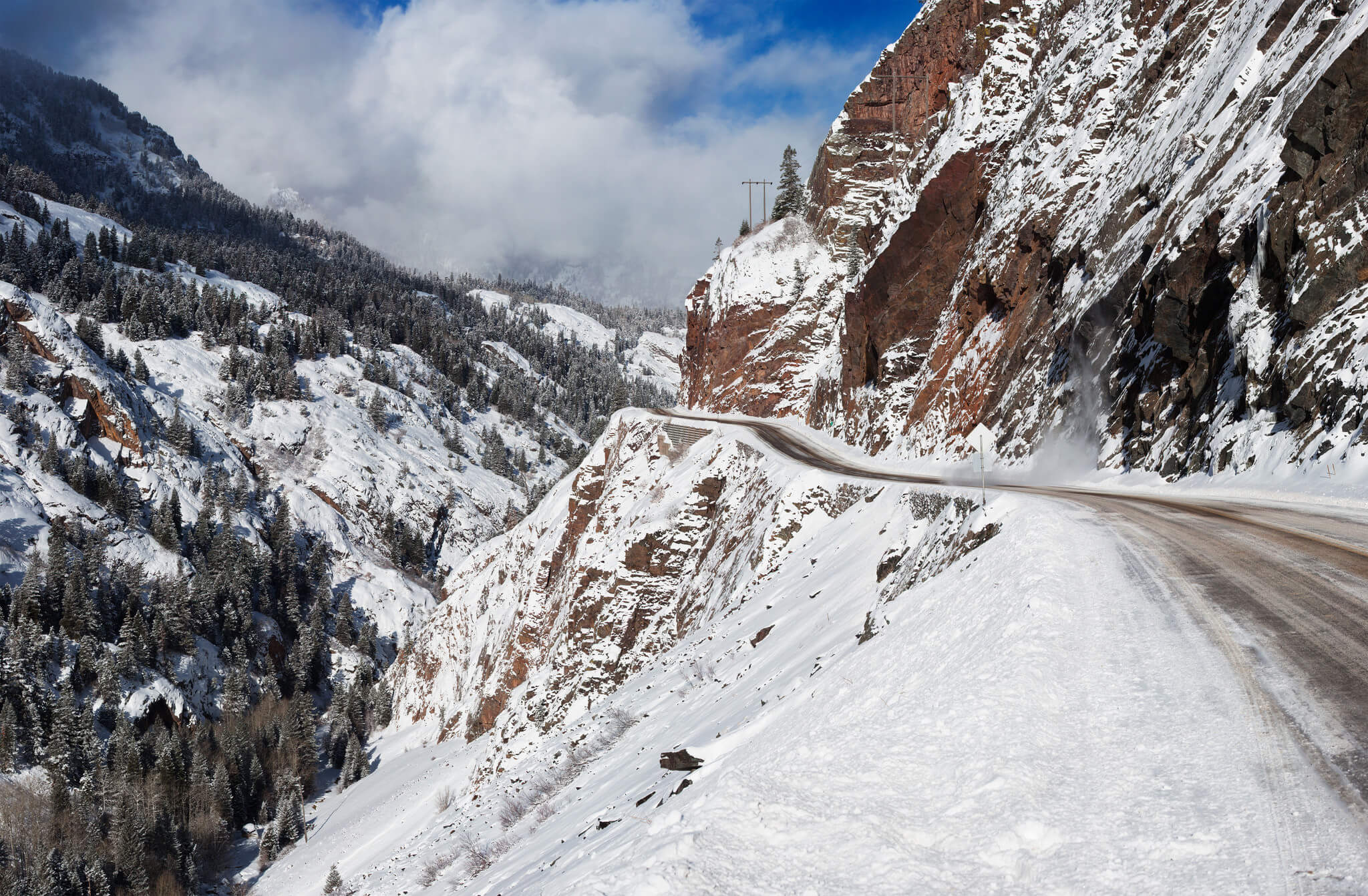
#1 – Red Mountain Pass, CO
Ski Resort: Silverton
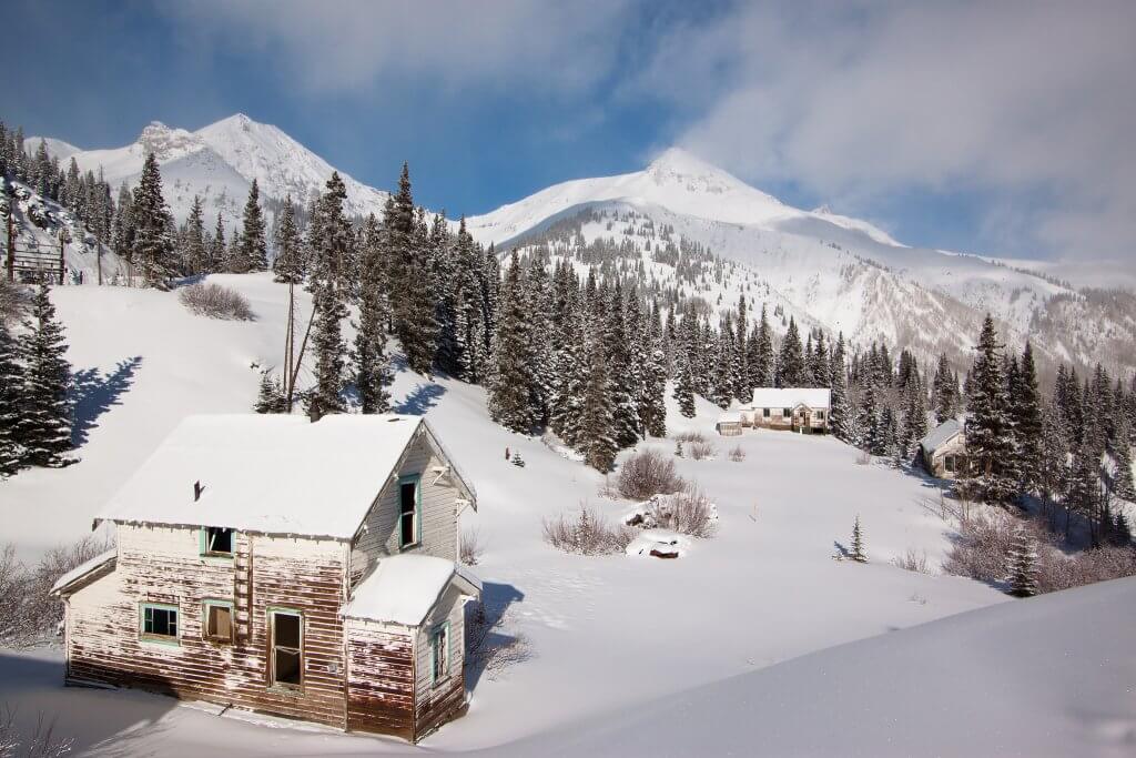
The Facts:
Switchbacks – 27
Max Grade – 8%
Elevation Gain – 4,100′
Colorado Route 550 is known as the Million Dollar Highway. If the elevation gain of 4,100′ to a summit of 11,018′ wasn’t enough, the road’s construction brings this bad boy to another level. First, a certain segment is cut directly into the mountain threatening to throw you into a ravine at the hint of an over-steer. Second, a 12-mile stretch of this road has NO guardrails, and if your heading south towards Silverton, the outside lane puts you perilously close to the edge. There was no question that this won the #1 slot.
Any others measure up?
Did your local mountain pass just miss out on the top 5? Were you expecting to see others on our list? Here’s a graphical breakdown of where the top 12 ranked against one another:


Sorry, but these all pale in comparison to most mountain roads in the Alps, let alone elsewhere 🙂 10% is your max grade? How about 18+? Got a number of those just within 2h drive. How about the average grade… http://bikestein.com/blog/10-best-most-beautiful-road-climbs-europe or just about any Tour/Giro/Vuelta mountain stage (note: most of these get you to ski resorts as well)
Single lane roads, switchbacks, no guard rails – got plenty of those.
I’ve driven on half of the roads on your list, both in summer and winter, so I do get to compare and put things in perspective, and I never felt even remotely uneasy. But yes, if your plan is to drive 80mph on summer tires during winter then these are all highly dangerous roads.
Thats odd. I lived in the Alps for 4 years and don’t remember ever seeing anything like you’re describing and I was positive that I had pretty much driven most of the Alps. I guess I just accidentally must’ve driven around them. Lol
NOTE TO EVERYONE: There’s always “that guy” who shows the world how they’ve “seen it all and done it all much better than you could ever imagine “, and the describes ol JT to the T. Lol 😆
Highway 88 in CA “The Carson Spur” accessing kirkwood should definitely be on your list! For the Tahoe area, it’s not as tall as the mount rose highway but definitely steeper and more switchbacks than highway 50 Echo and I80 Donner Summit
Hey Ryan, good catch! Did some quick research and it would rank as high as Teton Pass if you start at Barton, CA (3,271 ft) to the summit of Carson Spur. Elevation Gain: 5,381 ft Switchbacks: 20 and Summit Elevation of 8,657 help propel it way up to the top.
Surprised that you didn’t find Little Cottonwood Canyon in UT more dangerous, as the state of UT does. More something like 22 slide paths
If it was based on Avalanche risk Little cottonwood canyon in Utah would be #1on this list. With 64 slide paths in 6 miles. Most avalanche prone highway in north America.
Hey Michael,
Whoa! I didn’t know that it had that many. We did take into account avalanche danger but we also added multiple other factors as well such as deaths / year, amount of switchbacks, and how long it is just to name a few.
Bogus Basin in Boise, ID?
How about the road from Baldy Village to the Mt. Baldy lift? It is only about five miles but it has some nice switch backs and steep sections. It is scary with snow and ice on it. There are steep drops off the side and corners that are hard to make going up or down. This is close to Los Angeles just above Pomona. The Mt. Baldy Road is a lot more scary than most on your top 10.
Don’t forget to add the L.A. drivers factor. Idiots regularly turn an otherwise docile drive into .unnecessary treachery.
If you add drivers into the equation I think we beat all of these areas up here in Vermont. People from NY, MA, and of course NJ make driving interesting to say the least.
I agree. That little stretch from the village up to the Mt. Baldy parking lot is scary. Especially with the idiot LA drivers who have absolutely zero experience driving in snow.
Agreed w/Cottonwood. Having driven both BCC and LCC for nearly 35 years, LCC is definitely a more “treacherous” road. Although both Canyons are prone to avalanche, rockslide and slide offs, LCC is a shorter but steeper road. Amped!
Fun article! I have a much more interesting Mt Rose photo to do it justice if you want it.
Hey Tracy,
That would be awesome! Email the image to info@localfreshies.com
Thanks,
Alex
Old Highway 40, Donner SUmmit aka Old 40 should get an honorable mention lol it scares people as does 80.. Not us residents though
I remember a few years ago a big wheel truck got pretty scared coming down from Donner Pass towards Donner Lake during a storm. He stopped in the middle of the road and unhitched his trailer, left it in the middle of the road and drove off in his cab!
Agreed on the Mt Rose highway. There is one that’s pretty hectic in the Midwest… 78 & DL going to Devils Head in Wisco. Actually the Sawmill cutoff & Blackjack rd going to Chestnut (in IL) can be hairy too.
Powder Mtn Highway 158 instead of switchbacks it has a 16% grade !!
you can add Blacktail mtn near kalispell, MT to the list.
Ski Run Road to Ski Apache, Ruidoso, NM.
Ski Run Road to Ski Apache, Ruidoso, NM. I get a message that I’ve already said this, but I haven’t.
Hey Bill, I’ll have to check it out. 🙂
Absolutely!!!! We totaled our truck up there. It has a lot of switchbacks, s curves and the grade is pretty steep. Also, the is a long drop to the bottom if your car goes over the edge.
Woah! I guess I did. Well, a little déjà vu never hurt anybody.
Ski Run Road- Ski Apache outside Ruidoso. I’ve been up tons of ski roads, including big cottonwood and none come close. That being said it doesnt snow as much in south central New Mexico but still. It snows enough to make it a white knuckler.
Bolton Valley Access Road, Bolton, Vermont. 4.5 miles all uphill, 1400 feet of vertical, maximum grade 10%. Drive it in a Vermont snow and ice storm. You’ll understand. Down is worse than up.
Red Mountain Pass is the worst. This past winter of 2021-2022 I came across that this Pass is the most dangerous paved mountain pass in all of Canada and the United States combined. I also found out it is the tenth most dangerous paved mountain pass worldwide. Years ago on a ski trip to Alta Ski Resort, Utah there was an avalanche blocking Little Cottonwood Canyon Road. It took a day to a day and a half to clear that highway. In March, 2019 the Colorado Highway Department closed Red Mountain Pass for 17 days straight!!! They had two snowplowing crews working 12 shifts each 24/7 for these 17 days. I never heard of all of highway mountain passes in western United States closed down that long that kept opened yearlong like Red Mountain Pass, Colorado. I never been to this area myself other looking on YouTube videos. But I did drive through Wyoming, Utah, Idaho, Colorado, and New Mexico all in winter months years ago.
Gary
I90 @ Snoqualmie Pass shuts down ALL the time. Lots of cars and pretty steep.
Loved the article and appreciate the research!
I feel like annual fatalities or major auto accidents should be the number one criteria. I live in Seattle and while US 2 to Stevens Pass is far more dangerous from a techical perspective than I90 to the Summit at Snoqualmie, the sheer amount of unprepared, ill equiped drivers that try to drive over Snoqualmie pass in poor road conditions boggles the mind.