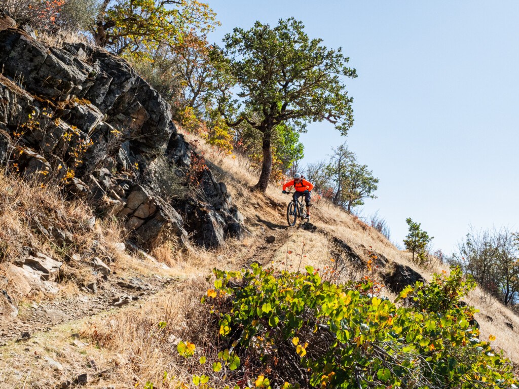
The definition of a “rogue” is someone who does things their own way. Someone with a wild spirit. While the general definition can have a negative connotation, that isn’t the case for the Mountain of the Rogue trail system. Rather, it perfectly captures the essence of the trail network. It goes against the grain of what you expect for Oregon mountain biking. Instead of pedaling under a forested canopy with tacky berms like Post Canyon, you’ll find a rough and rocky trail system entirely in the open, making it a very unique place in the Oregon biking scene.
Table of Contents
Where to Start

Located between Grants Pass and Medford, Mountain of the Rogue is conveniently accessible right off I-5 at exit 48. The main staging area, situated off North River Road, offers a well-maintained paved parking lot and even a bathroom. From here, all trails start and end at this trailhead, making navigation a breeze. Be aware that there is no water or trash cans available.
Location of Mountain of the Rogue Trailhead on Google Maps
Note: The parking lot is free, but this is a day use area only.
What to Expect

Built in 2015, it was southern Oregon’s first purpose-built trail system. It started with only seven miles of singletrack but has gradually grown to 13.5 miles of trails and more than 1,300 vertical feet of relief. While it isn’t huge, it does punch above its weight in quality and and makes for a great pit stop on your way to other destinations such as Ashland or heading south to Lake Tahoe. As mentioned earlier, this trail system is a contrasting experience to what’s mostly available in the state of Oregon. The landscape is characterized by tall grasses and dotted with madrones, rewarding you with miles of views of the Rogue River below and the nearby vineyards.
Designed for All Abilities
The trail system is designed similar to a layer cake. The first layer is ideal for beginners and intermediates. A good introduction of the best things mountain biking has to offer such as rollers, tabletops with optional roll-arounds, and large bermed turns. As you ascend, each layer becomes progressively rowdier, steeper, and more technical, with some exposure to spice it up even further.
Local Freshies® tip: Be VERY aware of poison oak. It grows feverishly alongside some of the singletrack. And with so much of the trail system exposed to the sun, keep an eye out for rattlesnakes too.
When to Visit

Being inland from the coast, low in elevation, and in the rain shadow of the surrounding mountains, you can enjoy the trails pretty much year-round. However, the ideal time to visit is in the fall and spring. The trail network is mostly sun exposed and can get quite warm in the summer months, so it’s best to go early in the day before it warms up. If the thermostat is cresting triple digits, consider hitting up Grants Pass’s other trail system Cathedral Hills for more shaded terrain.
In the winter, while snowfall is rare, most of the area’s precipitation occurs during this season. Avoid riding when the trails are wet or if the ground does freeze, a possibility in late December and January. When the top layer thaws, it turns into a slippery, peanut buttery surface.
MTB Trails We Hit
Trail conditions can change throughout the year, so check the latest Trailforks reports before heading out.
Rat Pack

While the descents are fantastic, you can really tell this is a purpose-built trail system when you experience the main climbing trail – Rat Pack. Instead of a soul punishing pedal like many old school climbing trails that were built for hiking, this one has just enough pitch to allow you to climb at a decent cadence and still take in the scenery. As soon as you leave the trailhead, you exit a stand of trees and begin the mellow 2.5-mile ascent through a series of switchbacks to the top.
For beginners, exit at the intersection of Pay Dirt for the easiest trails. The rest can continue climbing.
Dark Side
Since this was our second trail network of the day and we were running out of daylight, we decided to skip the final 500 vertical feet, which includes another trail called the Dark Side. According to our local guide, this is the most challenging section, featuring some punchy climbs.
Breakdown
The smooth, peanut butter-like dirt is filled with chunky pieces of rock that you have to navigate. As you continue your descent, the jumps get bigger and the berms become more pronounced. The highlight is when the trail bends around the mountain to the north, dropping through rocky ledges flanked by small cliff bands on the hillside. Not at all what I expected to find in Oregon.

Freewheel
After finishing Breakdown, up next was the cherry on top of our ice cream Sundae – Freewheel. This run snakes and pumps its way through table tops, easy doubled rollers (as you can see in the photo), and true kicker-style moon shooters that let you launch into perfect tailwhips. None of it’s mandatory but whoever built this route knew what they were doing, making you gain more confidence the farther you descend. Lots of little side hits and hip jumps too!
Pay Dirt
The farther you descend, the more forest intermixes with grassy hillsides, and the dirt takes on a more clay composition. Compared to the upper trails, Pay Dirt is more flowy and features perfectly sculpted rollers and banked berm turns that you crave. These elements ensure that you finish strong with a big grin on your face.
Arm Bar
We didn’t have the opportunity to ride it ourselves, but our friend described it as incredibly technical. It begins with a gradual ascent and swiftly cranks up the heat in technical terrain. One standout feature through the entire trail is exposure. Anticipate tightrope riding along a hillside and tackling several rocky sections, including a significant armored drop.
No Joke
If Arm Bar doesn’t satisfy your need for technical challenges, then No Joke is a must-try, accessible via Arm Bar. True to its name, No Joke presents numerous mandatory features, leaving little room for hesitation. Along the way, expect off-camber slabs, loose rocks, and tight turns demanding your attention as you navigate your way through it.
Dollar Mountain
And Mountain of the Rogue is no longer the only reason mountain bikers should consider stopping in Grants Pass. Dollar Mountain officially celebrated its grand opening on November 1, 2025, with the first 11 miles of purpose built mountain bike singletrack. Today, the trail system includes more than 11 miles of new multi use and mountain bike specific trails along with improvements to more than 20 miles of existing routes, creating over 30 miles of total trail access just minutes from downtown Grants Pass. We haven’t ridden it yet, but between Dollar Mountain and Mountain of the Rogue, Grants Pass is quickly becoming much more than a pit stop on a Southern Oregon mountain bike road trip.
And if you’re looking to add another ride while you’re in the area, Jaime and I also explored Cathedral Hills, another trail network just outside Grants Pass with a completely different feel from Mountain of the Rogue.