


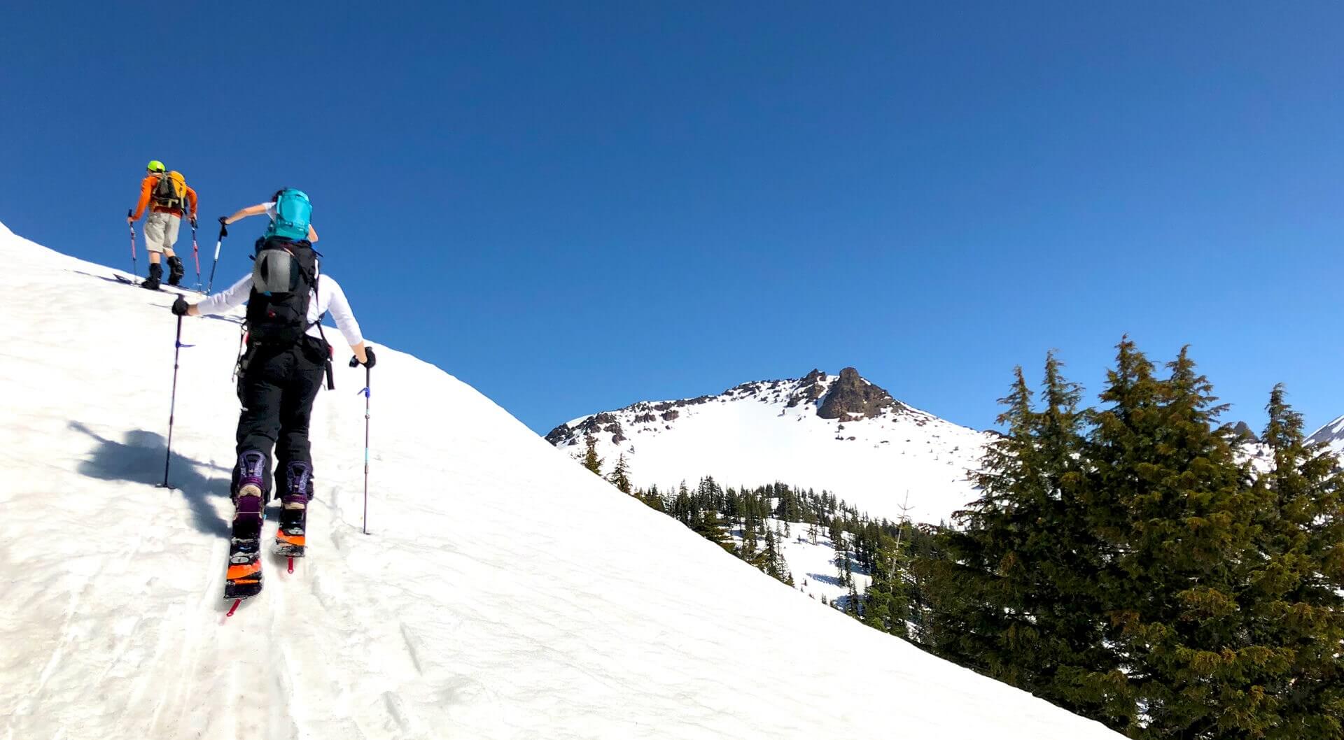
As ski resorts postpone or shutter for the season, many of us still are thirsting to make some turns. And with record setting snowfall, cold temps, and a deep snowpack, it means a lot of people are still getting after it. The scary part is that many people don’t spend any time planning their route UPHILL. For example, when we were out there last season, we saw someone kick-off a slide on their ascent. Looking at some statistics about incidents, over 36% of avalanche deaths happen during the ascent. Seeing where this particular slide took place, it could’ve been avoided with a little route planning. Instead of chastising, we thought… “Why not use this as an opportunity to help educate people?” A quick win for everyone is to use the CalTopo backcountry trip planner every time you go out.

What’s CalTopo Backcountry Trip Planner?
CalTopo is a website that provides a wealth of tools, giving you a basic lay of the land. Simply put, it’s the ultimate resource for backcountry skiers, splitboarders, backpackers, and hikers. We personally use it every time we step out into the wilderness.
How To Use CalTopo
As you pull up the website, the first thing you’ll notice is you may not know where to begin. Like any new tool, once you get a few quick tips, it’ll make more sense, and you can expand on it quickly. Here’s a quick crash course on how to plan your backcountry trip with CalTopo.
Identify Where You’re Heading
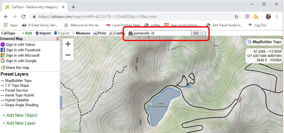
Start off by typing in the highlighted box the mountain peak or region you’re heading to. Then zoom in close enough so you can see the gradients.
Add Slope Shading
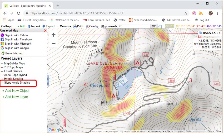
Click on the Slope Shading button. This will color the map so that you have an idea of where the slopes are near 30 degrees or steeper. Any slope that is 30 degrees or steeper is considered avalanche terrain.
Plan Your Route Up
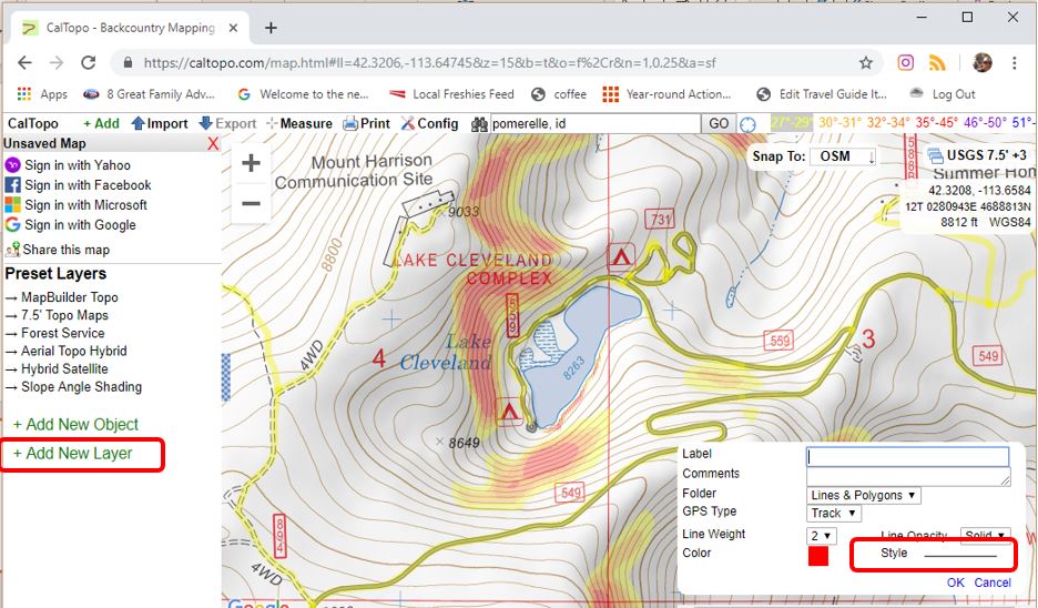
Now it’s time to plan your route up AND down. When climbing uphill, it’s always a good idea to avoid steep slopes. And not just because it’s avalanche terrain… but why make it more difficult for yourself?
- Click on Add New Object
- Click Line
- Click Style – From this you can pick how you want the line to look. For now, select the up-arrow type to show that’s how you’re going uphill.
- Now navigate back to the map and click where you’re going to ascend. Once done with the route, click OK.
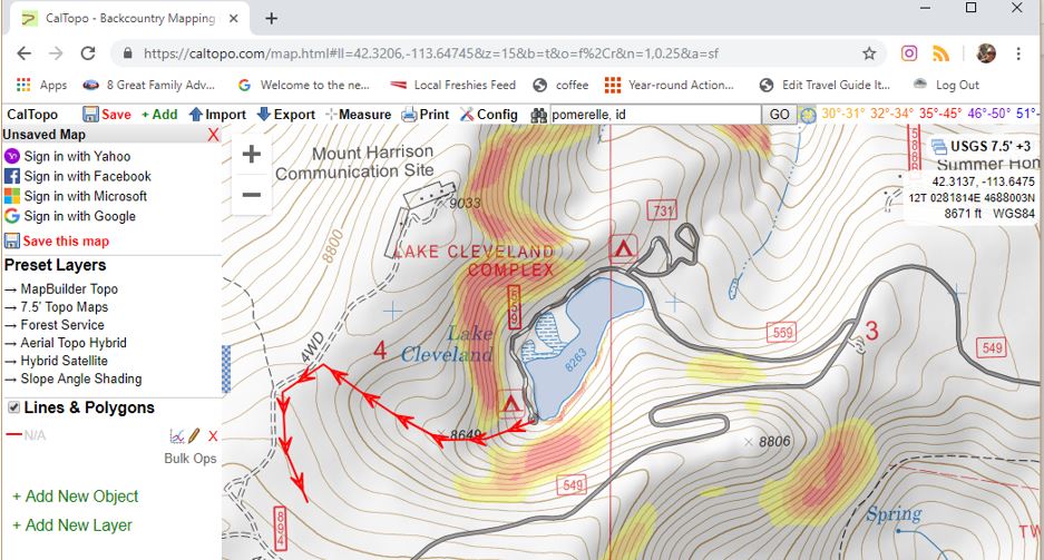
Do the same for the route down.
Note: This is only an introduction on how to plan your backcountry trip with CalTopo. We recommend taking an avalanche course and even a navigation class to get a true deep dive on this tool along with understanding the snow.
Get Educated Or Continue Education
During the season, it’s always good practice to read the forecast from your local avalanche center not just when you go out, but every day during the season. Avalanche.org is a great resource to find your personal avalanche center or where you’re planning on touring. With the ski resorts closed but the thirst for pow hunting still calling many of us, be extra cautious when venturing even inbounds this time of year. Ski patrol does a lot to mitigate these risks during the season. But, dangers are still lurking in late season (or when the resorts are closed) so be sure to carry a beacon, shovel, and probe. We aren’t the experts but hope this at least starts everyone on a path to begin or continue your avalanche education.


This was a great introduction to CalTopo. I’ve used the site to build maps more than once. It’s really good. I’m not in an area where avalanches are common, but I would still use your advice to plan a route.
The POM!!!