Imagine unloading your bike in South Lake Tahoe and pointing it south.
But you’re not in the Eastern Sierra yet.
First, you have to climb out of the Tahoe Basin, cross Armstrong Pass and drop through Charity Valley toward Markleeville. Through Charity Valley, you’d actually be traveling in reverse along part of the route John C. Frémont and Kit Carson used during their brutal 1844 crossing of the Sierra.
From Markleeville, you keep heading east before eventually dropping toward Highway 395 and into an entirely different landscape.
Now the real journey begins.
You’re moving through the Eastern Sierra’s frontcountry under your own power, from alpine forests and sagebrush to high desert and tiny towns strung along the base of the Sierra.
In some ways, it feels a little like the Pacific Crest Trail, except bikes are welcome and instead of disappearing deep into the backcountry, the route keeps reconnecting you with civilization.
That’s the vision behind East Side Sierra Towns to Trails.
And if that sounds like the ultimate bikepacking adventure, there’s one VERY important thing to understand:
The route exists. The finished experience doesn’t.
The current Eastside alignment is legal and rideable, but Towns to Trails is still evolving into the complete experience its creators envision. The feasibility study looked at roughly 350 miles of existing roads and trails between South Lake Tahoe and Lone Pine, and there are still gaps, problem areas and plenty of work required to turn that alignment into something riders can easily understand and follow.
Want to see just how massive this thing is? Check out the interactive Towns to Trails map showing the broader alignment, developed through a Sierra Nevada Conservancy grant awarded to ESCOG. Which is what makes the idea so interesting.
What if, instead of building hundreds of miles of new trail, we connected what the Eastern Sierra already has?
Table of Contents
- What Exactly Is Towns to Trails?
- Think Bikepacking, Not Bike Park
- Pearls on a Chain
- The Eastern Sierra Changes When You Get Out of the Car
- This Isn’t a Summer Bikepacking Route
- Three Sections John and Elaine Can’t Wait to Ride
- The Reality Check: The Route Exists, but It Isn’t Finished
- What Happens Next?
- What Would Success Look Like?
What Exactly Is Towns to Trails?
The idea grew out of the Sustainable Recreation and Tourism Initiative, or SRTI, an effort focused on helping rural Eastern Sierra communities build a stronger future around one of their greatest assets: the landscape surrounding them.
To better understand where Towns to Trails came from and where it could go, I spoke with John Wentworth of Mammoth Lakes Trails and Public Access Foundation, or MLTPA, and Elaine Kabala, Executive Director of the Eastern Sierra Council of Governments, or ESCOG.
As part of that process, communities were asked what kinds of recreation investments they actually wanted.
John Wentworth laughed when he told me what came out on top.
Better bathrooms.
Apparently even in one of the most spectacular landscapes in North America, everybody appreciates a good bathroom.
Right behind that though, was something much bigger: better cycling and trail infrastructure connecting communities throughout the region.
Use What We’ve Got

Building hundreds of miles of brand new trail in California is anything but simple. Fortunately, the Eastern Sierra already has an enormous web of forest roads, mining roads, utility corridors, doubletrack and existing trails created over generations.
That’s where the opportunity comes in.
Rather than trying to carve a brand new trail across the Eastern Sierra, Towns to Trails could connect much of what’s already there. If you really want to nerd out on the planning behind it, you can dig into the full Towns to Trails report.
As John put it: “Let’s roll this up into a master trail. Use what we’ve got.”
That sounds simple.
It isn’t.
Someone still has to figure out which roads and trails actually work together, where riders can legally travel, where sensitive resources need protection and where the route simply falls apart.
There are even places where the conceptual alignment still pushes riders onto Highway 395.
Which brings us to the bigger challenge.
A route can connect on a map and still suck to ride.
Think Bikepacking, Not Bike Park

If your idea of mountain biking involves knee pads, giant jumps and seeing how quickly you can destroy a rear wheel, Towns to Trails probably isn’t being designed with you in mind.
This isn’t Downieville stretched for hundreds of miles. That doesn’t mean there isn’t legitimate mountain biking along the way. Some sections absolutely deliver real singletrack and technical riding.
But overall, the vision leans much more toward bikepacking, gravel and long distance adventure. The point isn’t finding the rowdiest trail. It’s using a bike to move through the landscape and connect places that feel completely different at 10 mph than they do at 65.
That’s where the PCT comparison starts making sense.
The PCT is fundamentally a backcountry experience. Towns to Trails is much more frontcountry, continually reconnecting riders with communities along the way.
Instead of trying to avoid civilization, the towns are part of the journey.
Pearls on a Chain
John described the communities along Towns to Trails as “pearls on a chain.” The trail may connect them, but the towns themselves are a huge part of what could make the experience special.
If the goal were simply to pedal from South Lake Tahoe to Lone Pine, you could draw a line on a map and call it a day. The bigger idea is to slow people down enough that these communities become part of the voyage rather than places they blow past on Highway 395.
Bishop Is More Than a Resupply Stop

Bishop might be the best example.
After hours crossing high desert beneath the Sierra, imagine suddenly rolling onto something that’s disappeared from a lot of America: a true Main Street.
Bishop’s downtown is still filled with locally owned businesses tied directly to the community. Even places like the historic Bishop Twin Theatre have been refurbished rather than replaced, keeping another piece of that identity alive.
Arriving by bike would feel completely different than pulling off Highway 395 for lunch. You’re moving slowly enough to walk Main Street, talk to people, learn some of the history and understand why Bishop has become such an important hub for climbers, hikers heading deep into the Sierra, skiers, cyclists, ranchers and generations of people who simply call the Owens Valley home.
That’s what John means by the towns being pearls on a chain.
And it’s also why figuring out the actual experiences hidden inside the larger route could represent as much as two thirds of the work. Most people probably aren’t riding from Tahoe to Lone Pine. They might want an overnight between two towns, a weekend adventure or a few days where each ride ends somewhere with a hot meal and a bed.
For the communities, that’s where the idea gets interesting too. The goal isn’t simply to send cyclists through town. It’s to give them a reason to stop, stay and become part of the place for a little while.
The landscape gives people a reason to come. The communities give them a reason to stay.
The Eastern Sierra Changes When You Get Out of the Car
Anyone who has driven Highway 395 knows how spectacular the Eastern Sierra can be.
The problem is, you’re still experiencing it through glass and steel.
You see how violently the Sierra rises out of the Owens Valley. Farther south, the White Mountains rise to the east, creating this enormous corridor with mountains towering over both sides of you.
But cycling through it is different.
On a bike, the landscape stops being scenery and starts becoming something you’re actually moving through. You smell sagebrush warming in the sun. You feel how quickly the temperature changes when you move from an exposed valley floor into the shade of an aspen grove.
Things that barely register at highway speed suddenly become part of the experience.
John kept coming back to that idea:
“Our equity is our landscape.”
For the rural communities scattered along the Eastern Sierra, those mountains, valleys and deserts aren’t simply the backdrop. They’re one of the greatest resources the region has.
Water Tells a Bigger Story
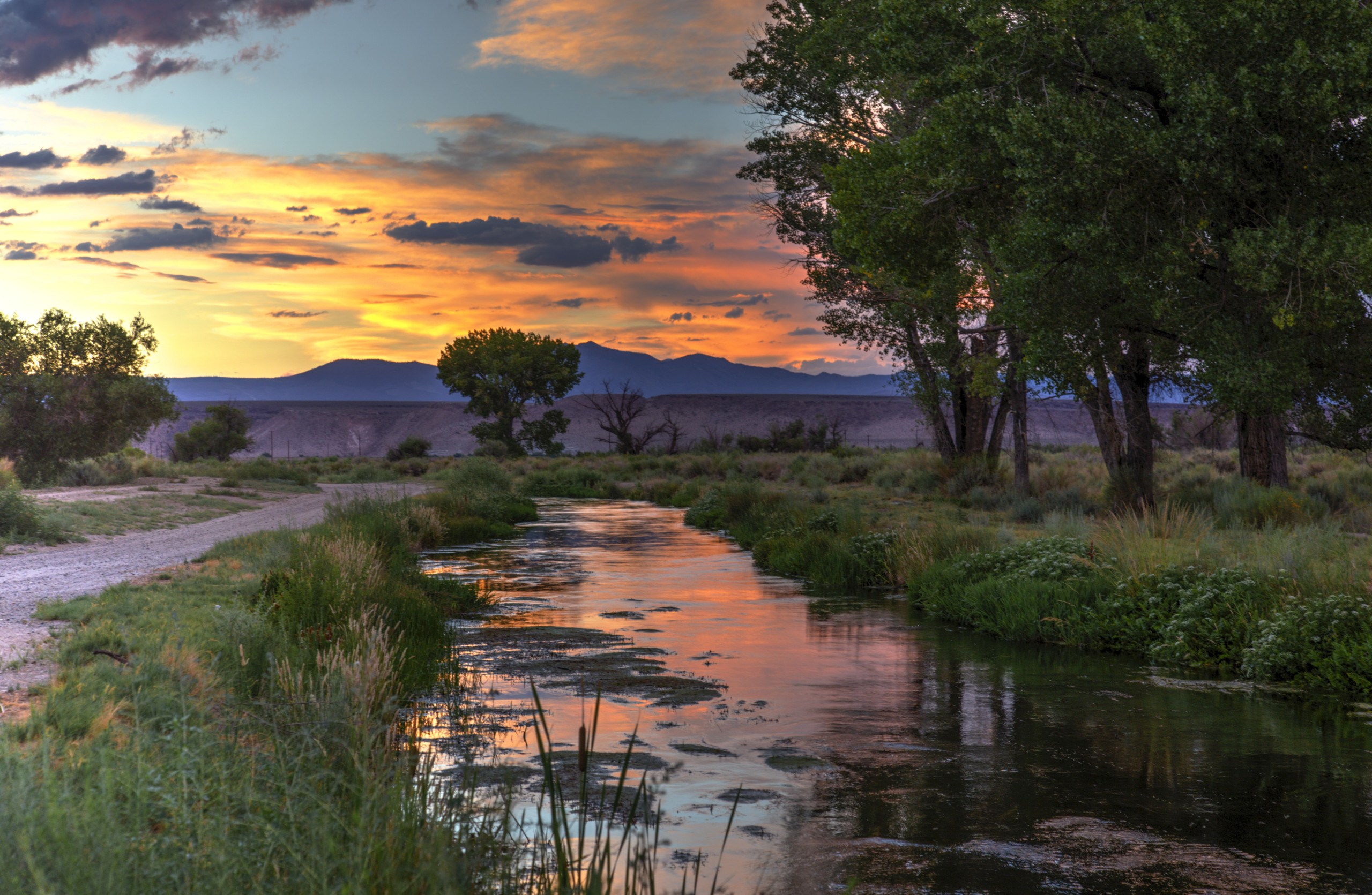
One of the best examples is water.
From Highway 395, the creeks, canals and other waterways crossing the Owens Valley can almost disappear into the scenery. Spend hours moving through the valley at bike speed and suddenly you start seeing how they connect.
Water coming out of the Sierra feeds a network of creeks, canals and infrastructure tied to communities hundreds of miles away.
And then you start asking questions:
Where is that water going? Who depends on it? Why does this landscape look the way it does?
That curiosity is part of what John and Elaine hope Towns to Trails creates.
The same thing happens with the scale of the mountains. Mt. Williamson looks enormous from Highway 395, but pedal beneath it for hours and the Sierra stops feeling like something beautiful in the distance.
It becomes a wall beside you.
That’s what makes Towns to Trails more interesting than simply creating another long distance bike route. It gives people enough time outside the car to actually notice where they are.
And maybe care about it a little more because of it.
This Isn’t a Summer Bikepacking Route

Summer might seem like the obvious time for a big bikepacking trip, but on the East Side it can be one of the least forgiving times to attempt it.
The Owens Valley can get brutally hot at lower elevations, while winter creates the opposite problem. One major Sierra storm can completely change what’s rideable.
That leaves the sweet spot: spring and fall.
And honestly, that may make the experience even better.
Spring in the Eastern Sierra is something special. Sunshine warms your skin while cool air keeps the riding comfortable. Hundreds of wildflower species occur across the region, and in a good spring, the floral display can spread across the Owens Valley floor while snow still blankets the Sierra above you.
Fall brings its own magic as the heat backs off, aspens change colors, and the first dusting of snow returns to the peaks.
You’re riding through the changing of the seasons.
Much like someone planning a thru hike on the PCT, timing becomes part of the adventure. Conditions near Tahoe could be completely different from what riders find hundreds of miles farther south near Lone Pine, so figuring out when each section is at its best may be just as important as figuring out how they connect.
Three Sections John and Elaine Can’t Wait to Ride
The full journey from Tahoe to Lone Pine may grab the headlines, but when I asked John and Elaine where they’d send someone tomorrow, they immediately started talking about individual sections.
These aren’t finalized itineraries. Think of them as a glimpse at the completely different adventures hiding inside the larger route.
Lee Vining Through Bodie to Bridgeport

John pointed toward a route beginning around Lee Vining, climbing into the Bodie Hills, pedaling directly through the ghost town of Bodie and eventually working toward Bridgeport and Virginia Lakes.
This is where Towns to Trails starts feeling less like traditional mountain biking and more like true bikepacking. You leave Lee Vining behind and climb into the high desert and volcanic terrain of the Bodie Hills, where the towns grow farther apart and simply getting from one place to another becomes part of the adventure.
In some ways, the bicycle becomes the modern version of the horse that once carried people through this country. You’re moving slowly enough to feel the distance between places and get at least a tiny sense of what traveling across the Eastern Sierra might’ve felt like before Highway 395 made everything so easy.

That makes arriving in Bridgeport especially fitting. The historic Bridgeport Inn has a room named for Mark Twain, tied to the long told local story that he once stayed there while traveling through the region toward Bodie.
And considering Twain later wrote one of cycling’s all time great lines, it’s hard not to appreciate the connection:
John joked that this stretch would appeal to the “gravel riding snobs.”
He isn’t wrong.
If debating 42mm versus 45mm tires sounds like a good time, welcome home.
Independence to Lone Pine

Then there’s the stretch Elaine would most like to experience from the saddle.
She grew up here and has traveled between Independence and Lone Pine plenty of times. But seeing the landscape through a windshield and actually moving through it by bike are two very different things.
“I grew up here. I can’t wait to go Independence to Lone Pine.”
Heading south from Independence puts you beneath some of the biggest terrain in the Sierra Nevada. Mt. Williamson rises more than 14,000 feet above sea level, and from the Owens Valley, its eastern face feels almost absurdly large.
Instead of watching it slide past the passenger window, you’d spend hours underneath it.

Eventually Lone Pine and the Alabama Hills come into view, trading the massive wall of the Sierra for rounded granite formations Hollywood has spent generations transforming into everything from the Old West to landscapes that weren’t even supposed to be Earth.
The distance between Independence and Lone Pine isn’t the story.
Everything you experience between them is.
South Lake Tahoe to Markleeville

And then there’s the beginning.
Out of the sections John and Elaine talked about, South Lake Tahoe to Markleeville may be the most turnkey for riders looking for a legitimate mountain bike experience.
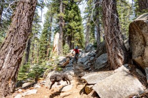
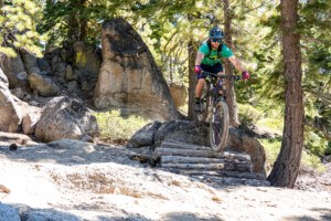
Armstrong Pass is already one of my personal favorites as an out and back, with real singletrack, granite, big views and enough technical riding to keep things interesting. Continue beyond the pass and Charity Valley adds the kind of raw downhill mountain bikers crave. Personally, it’s been on my hit list for a while as a shuttle ride.
You start beneath the pines and granite of Tahoe, climb toward Armstrong Pass and drop through Charity Valley toward Markleeville. Somewhere along the way, you’re not just leaving the Tahoe Basin. You’re crossing into another side of the Sierra.
There’s history beneath your tires too. Charity Valley traces part of the country Frémont and Carson traveled during their 1844 Sierra crossing.
Then you roll into tiny Markleeville, and if you’re doing this properly, head straight toward the Cutthroat Tavern for a well earned watering hole stop.
Cutthroat isn’t just conveniently sitting at the end of the ride. The people behind it have also been foundational supporters of the larger effort to connect these communities by trail, which makes stopping there feel appropriately full circle.
Start beneath the pines of Tahoe. Climb over the mountains.
Rip a legitimate Sierra descent.
Roll into Markleeville. Grab a drink at the Cutthroat.
Then keep going until the landscape changes all over again.
One Route, Dozens of Adventures

These three sections reveal something important about Towns to Trails.
The real opportunity isn’t creating one giant adventure. It’s creating dozens of them.
Most riders probably won’t bikepack all the way from Tahoe to Lone Pine. But a day on Armstrong and Charity Valley? A weekend through Bodie? Independence to Lone Pine? Something mellow with the family?
That’s where this concept could really open up.
The Reality Check: The Route Exists, but It Isn’t Finished
Here’s where Towns to Trails gets a little confusing.
According to John Wentworth and the Towns to Trails team, the current Eastside route is already legal, established and available for anyone who wants to ride it. Even more surprising, roughly 95 percent of the current route is on dirt.
But that doesn’t mean the finished Towns to Trails experience is done.
There are still a couple of gaps where the team is looking for better soft surface solutions, including areas where riders can be pushed onto Highway 395. Technically, that gets you from Point A to Point B.
Experientially?
Nobody’s dreaming about bikepacking down 395 with semis blowing past them.
That’s the difference between proving a route can connect and creating something people will actually travel here to ride.
The Experience Has Already Been Tested
There’s already evidence the bigger idea works.
In fall 2024, Dillon Osleger rode from South Lake Tahoe to Mammoth Lakes, piecing together singletrack, dirt roads and existing connections as a real world test of the concept. He approached it as a “credit card bikepack,” riding roughly 30 to 50 miles at a time while his family met him farther down the route.
And the important part wasn’t simply that he made it.
The experience worked.
That’s exactly what John and Elaine hope Towns to Trails eventually becomes.
What’s missing is the system around it: safe connections, clear wayfinding, reliable information, logical places to eat, sleep and refill water, and enough local knowledge that visitors know what they’re getting themselves into.
The bones are there. The experience is there. Now it has to become something people can actually follow.
What Happens Next?
From a Route to a Network
The East Side is the more developed piece of Towns to Trails, but John and Elaine are already looking beyond a single north to south route.
A West Side Towns to Trails plan is much earlier in the process. If it eventually comes together, that’s where things get really interesting.
Most trails coming out of Eastern Sierra communities naturally run east and west toward the mountains. Towns to Trails creates something different: a north to south backbone that could connect them.
Towns to Trails also exists alongside another much bigger north to south cycling vision: Orogenesis. John expects the two routes probably share a significant amount of existing trail and dirt road infrastructure, although exactly where they overlap and intersect hasn’t been fully mapped between the two teams yet.
That relationship could become increasingly interesting as both projects evolve. Rather than thinking of these as completely separate routes, portions of the same existing infrastructure may ultimately help support multiple ways of traveling through the Eastern Sierra and beyond.
Suddenly you’re not limited to one giant ride from Tahoe to Lone Pine. You could build loops, leave a town in one direction and return through a completely different landscape, or spend several days linking trails that today feel disconnected.
It starts looking less like one bikepacking route and more like an entire network of adventures.
What the PCT Gets Right About Trail Towns
But the route can’t simply be designed on a map. John and Elaine emphasized that the communities along it need to help shape what Towns to Trails becomes.
The PCT offers a glimpse of why that matters. Its trail towns give long distance hikers places to resupply, eat, sleep and recover while those same hikers support businesses along the route.
Towns to Trails could develop its own version of that relationship, but it has to work for the people who already live here too.
That means considering everything from equestrian access to sensitive resources and what increased recreation could mean for places that haven’t historically seen much traffic.
The goal isn’t simply getting more people onto public land.
It’s figuring out how to share this enormous landscape without loving it to death.
What Would Success Look Like?
When I asked John and Elaine what they hoped riders would feel after experiencing Towns to Trails, their answer was simple:
Awe. And love.
Awe comes pretty easily in the Eastern Sierra.
Love takes longer. It comes from slowing down enough that a town stops being somewhere you pass on Highway 395 and the mountains stop being scenery through a windshield.
You start seeing the history, the people and the little things connecting this enormous landscape together.
John called the Eastern Sierra “the gift that keeps on giving.”
Towns to Trails could simply give people another way to unwrap it.
The mountains are already there. The dirt is already there. The towns are already there.
Now the question is whether they can connect the dots.