


There’s a lot of buzz on what the upcoming winter season will look like based on the Farmer’s Almanac’s & NOAA’s predictions. From La Niña to La Nada, there are conflicting reports on what exactly will happen this winter. This raised the question, “How did both of these long range weather predictors do last winter?” The 2015-16 ski season was highlighted by the threat of a “super” El Niño made by NOAA. NOAA forecasters called for flooding in California, drought in the Rockies, and a frigid winter in the Southwest, while the Farmer’s Almanac predicted the opposite in some regions. Well, what really happened? Let’s take a look at the accuracy of the Farmer’s Almanac and NOAA’s to see which one got it right: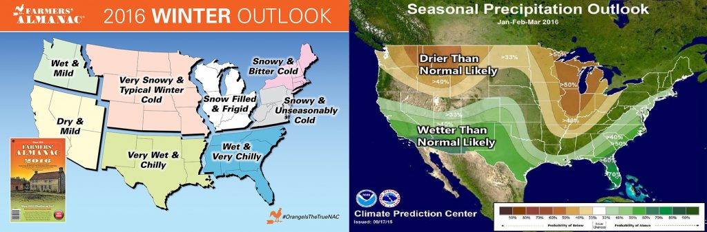
The Northeast
Farmer’s Almanac:
Winter will be much colder than normal, with near-normal precipitation and below-normal snowfall. The coldest periods will be in mid-to-late December, early-to-mid January, and mid-to-late February. The snowiest periods will be in mid-to-late November, mid-to-late December, and early-to-mid March. April and May will be warmer and wetter than normal in the North and much warmer and drier than normal in the South.
NOAA:
December to February there is an equal chance of average temps and average precipitation. For March through May there is 50% chance of above average temps and average precipitation.
Winner: None – just a big ‘ole goose-egg!
Reasoning: With one of the worst seasons on record with below normal snowfall and above average temps, neither forecast was even remotely correct for the East Coast. The Farmer’s Almanac suggested a much colder winter with near normal precipitation while NOAA hinted towards an average winter which didn’t happen.
Northern Rockies
Farmer’s Almanac:
Winter temperatures will be above-normal, with below-normal snowfall and above-normal precipitation. The coldest periods will be late December and mid-to-late February. The snowiest period in northern and central sections will be in early December and mid-February. April and May will be slightly drier than normal, with near-normal temperatures.
NOAA:
From December to February, there is a 40% probability of warmer than average temperatures and 50% probability of drier than average precipitation. For spring (March through May), there is a 50% probability of warmer than average temps and a slight chance of below-average precipitation.
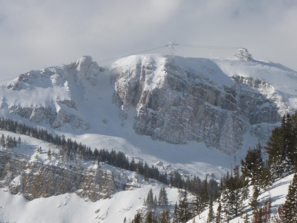
Winner: NOAA
Reasoning: Both predicted below-average snowfall during the course of winter, but with tons of snow in December, January, and early February, the intermountain west was near or above average and February contained the only major warm spell. The tie breaker went to NOAA for forecasting that spring would be warm, which it was during April.
Colorado
Farmer’s Almanac:
Winter temperatures will be above-normal, with below-normal snowfall and below-average precipitation. The coldest period will be mid-December. The snowiest period will be mid-February and early-to-mid March. April and May will be slightly drier than normal, with near-normal temperatures.
NOAA:
From December to February there is equal chances of average temperatures and 33% probability of drier than average precipitation. For spring (March through May) there is equal chances for average temps and a 50% chance of above-average precipitation.
Winner: NOAA
Reasoning: Colorado had in fact big snows in December and January followed by above-average snow and cooler than normal temperatures for April and May, which is just what NOAA predicted.
Utah
Farmer’s Almanac:
Winter temperatures will be above-normal, with below-normal snowfall and with precipitation above-normal in the north. The coldest periods will be late December and mid-to-late February in the north, and mid-December for the south. The snowiest period in northern and central sections will be in early December; mid-February and early-to-mid March in the south. April and May will be slightly drier than normal, with near-normal temperatures.
NOAA:
During mid-winter (December to February) there is a 30% chance of above average temps and a 40% chance of drier than average precipitation. For spring (March to May) there’s a 30% probability of warmer than average temps and 30% chance of above average precipitation.
Winner: NOAA
Reason: Farmer’s Almanac predicted below normal snowfall, but above normal precipitation translating to storms that were too warm. The reality was that they got consistent storms, but very small. In addition to the consistent snowfall of 1-2 feet every week for March and then the three storms in April/May, this pattern made it the best part of the season, so the winner by a slight margin would be NOAA.
Pacific Northwest
Farmer’s Almanac:
Winter temperatures will be higher than normal, with below-normal snowfall. Precipitation will be below normal in Washington and Oregon and near normal in northern California. The coldest periods will be in late December, mid-to-late January, and late February, with the snowiest periods in late December and mid-to-late January. The Pacific Northwest will receive big snow falls early on in the season before snowfall tapers off throughout the spring. April and May will be slightly drier than normal, with near-normal temperatures.
NOAA:
December to February there is a 60% chance for above average temps and 40% chance for below average precipitation. March to May there is also a 60% probability of warmer than average temps and 30% chance of below-average precipitation.
Winner: Oh No! Another big ‘ole goose-egg.
Reason: Both predicted below-average precipitation and above-average temps for the first half of winter. With average snowfall but high snow levels, this means they were both off in their prediction. Farmer’s Almanac did predict big snowfalls at the beginning of the season, but the overall prediction was incorrect.
Lake Tahoe
Farmer’s Almanac:
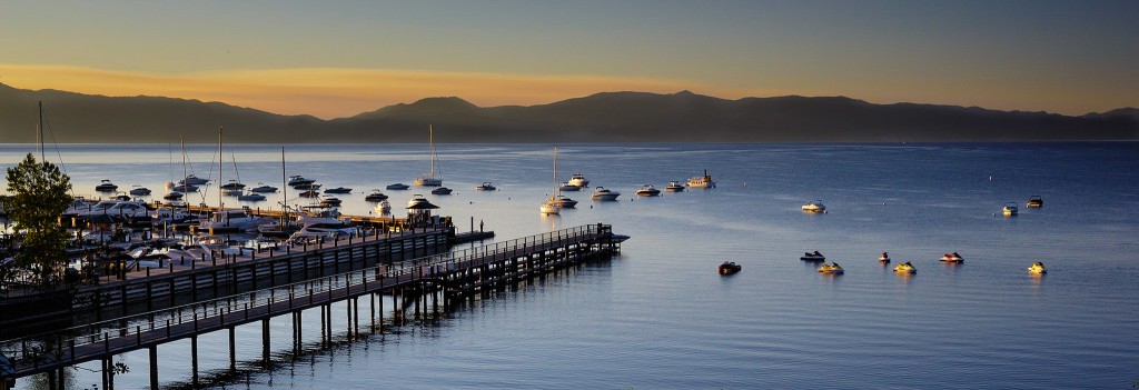
Winter temperatures will be above-normal, with below-normal snowfall and with precipitation above-normal. The coldest periods will be late December and mid-to-late February. The snowiest period in northern and central sections will be in early December. April and May will be slightly drier than normal, with near-normal temperatures
NOAA:
December to February there is a 40% chance of above average temps for Lake Tahoe and a 30% chance of above average precipitation for the Lake Tahoe region. In March through May, there is a 40% probability of warmer than average temps with 33% chance of above average precipitation.
Winner: Farmer’s Almanac
Reason: Both suggested above average temperatures translating to less snow and more rain which is what happened. Farmer’s Almanac won by a slight margin because they predicted that April and May would be drier than normal AND suggested that the winter would start out good and slow down towards the end, which it did.
Mammoth / Southern California
Farmer’s Almanac:
 Winter temperatures will be above-normal, with below-normal snowfall and precipitation. The coldest period will be mid-December and snowiest periods will happen in mid-February and early-to-mid March. A precipitous beginning to the winter but a dry spring is in the forecast for the Golden State. April and May will be slightly drier than normal, with near-normal temperatures
NOAA:
December to February there is equal chances for normal temps in southern California and nearly a 70% chance of above average precipitation for Southern California. For March into May there is a 30% probability of warmer than average temps in places like Big Bear and 40 % chance of above average precipitation.
Winner: Farmer’s Almanac
Reason: NOAA predicted an amazing winter for Southern California and it suffered a poor season. The Farmer’s Almanac predicted that it would be drier and stated that the winter would start out good and slow down towards the end, which it sure did.
So…who is the winner for predicting last season? It’s a split decision!
Specific regions: NOAA – 3 ; Farmer’s Almanac – 2
Overall 2015-16 season: Farmer’s Almanac
The Farmer’s Almanac hit it out of the park for the Lake Tahoe and Southern California predictions but just lost with their Utah forecast. NOAA called for a strong El Niño and leaned towards that weather pattern overall yet it only occurred for a couple weeks in December so it didn’t really happen. Overall, the Farmer’s Almanac was closer in their general winter guidance. Does that mean Farmer’s will be right overall this year? Maybe/Maybe not.
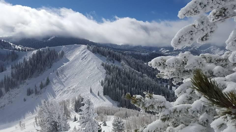
Summary of Last Season
For those of you curious how the 2015-16 ski season went down in North America check out the following from Bestsnow.net:
- Most of November: Snowfall was heaviest in western Canada. Other regions had smaller storms, which included some rain at lower elevations along the West Coast.
- End of November to mid-December: The Northwest had several intense storms totalling 6-8 feet, with lesser amounts spreading south into California. These storms split as they moved inland with the northern track into Idaho and Canada and the southern track moving SE into Arizona, New Mexico and southern Colorado. Utah and much of Wyoming and Montana missed out on these storms.
- Second half of December: The entire West was hammered with snow the week before Christmas with smaller storms ensuing during the holiday period.
- First half of January: The first week of January was the only for the entire season that a storm on the touted El Niño track came through SoCal, Arizona and New Mexico. The Sierras and Utah got the most snow, but all regions received at least 18 inches.
- Mid-January to beginning of February: Snowfall was above average in most regions with the most in the Tetons and northern Utah and Colorado. The Northwest had some rain but also lots of snow to maintain good conditions a majority of the time.
- The rest of February: The final January storm hit Colorado in early February, but after that, most of the western US had less than half normal snowfall the remainder of the month. Only Washington State and western Canada were closer to average. February was also unusually warm so spring conditions developed in many areas.
- First half of March: Major storms totalling 5-9 feet hit the West coast, with about 1/3 of that reaching most inland regions. The far Southwest remained bone dry as in most of February.
- The rest of March: Northern Utah and Colorado had above average snowfall while other western regions were below average with spring conditions emerging in most areas. The seven week Southwest drought lasted until 1-2 feet fell at the very end of March.
- First half of April: Weather was abnormally warm and dry, with just a few modest snowfalls in Colorado. All open areas had nearly all spring conditions.
- Rest of April/May: Few areas were open, but California, Utah and especially Colorado had above average snow and cooler than normal temperatures. Record heat and snowmelt continued in the Northwest, Northern Rockies and western Canada.
2015-16 was the third strongest El Niño on record. It did bring several stretches of high temperatures but the overall snowfall record did not display the pattern of past strong El Niño seasons. The regions that were supposed to be below average (Northwest, northern Rockies of both US and Canada) had the most snow relative to average in North America. And, it would have been far above average if not for a super warm and dry April. Meanwhile Southern California and Arizona, historically most favored by El Niño, came in at 59% and 78%.


One thought on “Farmer’s Almanac vs. NOAA In The 2015/16 Season – And the medal goes to…”