Bear. Bear. Cow. MTBing Teton Valley’s Horseshoe Canyon
Looking for a mountain bike trail that delivers the iconic tacky dirt Teton Valley is famous for, but without the crowds? Horseshoe Canyon near Driggs, Idaho should be at the top of your list. Tucked into the quiet Big Hole Mountains just 10 miles west of town, this 13-mile trail network is one of the best beginner-to-intermediate rides in the region. In fact, it’s the perfect first ride in Teton Valley, giving you a taste of the region’s famous tacky dirt without committing to an all-day epic. Expect smooth, flowing singletrack, breathtaking views of the Tetons, and surprisingly diverse terrain that transitions from open sagebrush hillsides to cool, forested singletrack.
Why We Picked Teton Valley
For us, the list of places to road trip for mountain biking is pretty short. We want cool weather, tacky dirt, and plenty of trails to explore, and Teton Valley delivers all three. While Grand Targhee and Teton Pass get most of the attention, Horseshoe Canyon is one of the valley’s three major riding areas. Located just west of Driggs in the Big Hole Mountains, its 13-mile trail network is just one part of the 70+ miles of singletrack that make up the greater Big Holes trail system. It’s a favorite for locals looking for an after-work ride or visitors easing into a Teton Valley mountain biking trip.
With the bikes loaded and the truck gassed up, we pointed the rig east toward the Idaho-Wyoming border. Like any good road trip, we couldn’t resist a few detours. On the way north, we stumbled across a hidden gem just outside Idaho Falls before eventually arriving at Horseshoe Canyon.
Horseshoe Canyon at a Glance
| Horseshoe Canyon Overview | |
|---|---|
| Location | Driggs, Idaho |
| Trail Network | 13+ miles |
| Difficulty | Beginner to Intermediate |
| Climbing | ~1,500 ft |
| Ride Time | 2–4 hours |
| Best For | Flowy singletrack, Teton views, uncrowded rides |
| Best Season | June–October |
| Trail Association | Mountain Bike the Tetons |
| Cell Service | None (plan ahead) |
| Bear Country? | Yes — carry bear spray |
Before You Arrive at the Trailhead
Heads up: while Horseshoe Canyon offers scenic, flowing singletrack, it’s also well off the beaten path. There’s no cell service, so once you’re out there, you’re on your own. Anytime we head into the backcountry, we always let someone know where we’re riding and when we expect to be back, and we’d recommend doing the same here.
Before leaving the trailhead, take a minute to make sure you’re carrying the essentials. At a minimum, we’d recommend downloading offline maps, packing bear spray, and bringing plenty of water. If you’re carrying a water filter, there’s a creek about halfway through the ride where you can refill if needed. Finally, don’t forget to check the latest trail conditions from Mountain Bike the Tetons before heading out.
Not sure what you should carry on a ride like this? Whether you’re heading out for a quick spin or an all-day backcountry adventure, we’ve put together a comprehensive guide covering the gear we never leave home without.
Our Favorite Horseshoe Canyon Loop
While Horseshoe Canyon’s individual trails aren’t especially long, they connect beautifully into one memorable ride. If this were our first time visiting again, this is the loop we’d recommend. It showcases nearly everything that makes Horseshoe Canyon special: Teton Valley’s legendary tacky dirt, flowy singletrack, incredible views of the Tetons, and enough variety to keep the ride interesting from start to finish.
Expect a leisurely 2 to 4 hours in the saddle, depending on how often you stop to admire the scenery or snap a few photos.
Difficulty: Intermediate
Distance: ~12 miles | Elevation Gain: 1,500 Feet
Start: Nickerson Grove Trailhead
Climb: Descend down Old Horseshoe Road -> Channel Lock -> LEFT onto Southbound Connector -> Sodbuster -> Bumper – Cody’s
Descend: Probation
Climb: Burgh
Descend: Shark’s Belly -> Bovine Bliss -> Training Wheels -> Old Horseshoe Road
Where to Start
From downtown Driggs, take Bates Road west for about 6 miles. You’ll be forced to turn right onto N 7000 W. About a half mile later, turn left onto W 1000 N, which eventually becomes Old Horseshoe Road. Keep following it until the pavement ends at the Nickerson Grove Trailhead.
Parking is free, but there are only a handful of spaces, so arriving earlier on weekends isn’t a bad idea. There are no restrooms or potable water at the trailhead, so come prepared. If you’re carrying a water filter, however, a creek roughly halfway through the ride offers a chance to refill before continuing.
Pulling into the trailhead, I couldn’t believe how empty it was. There was just one car, and that person was only there to walk their dog. The only sounds were birds chirping and a few crickets. Regardless of what the trail had in store for us, the opportunity to spend an entire day riding without seeing another person was worth the trip.
What to Expect on the Trail
The terrain itself will challenge a beginner but every experienced mountain biker will enjoy the flowy singletrack. Not a HUGE amount of climbing but with a base elevation of 6,300’, a decent fitness level is recommended. Here’s a run down of our experience mountain biking Horseshoe Canyon.
Climbing into Horseshoe Canyon

When it comes to getting into the Horseshoe Canyon trail system, you’ve got a couple of solid options. If you’re up for a full singletrack loop, climbing up Channel Lock is a great way to start. The other option? Take the Horseshoe-Packsaddle Road.
We went with the latter—it looked like the easier climb, and we were all about keeping things mellow that day. Under a bluebird summer sky, we settled into a steady rhythm and spun our way up the gravel road, slow and steady.
Wildlife Encounters in Horseshoe Canyon
As we zipped up the meandering route, we suddenly heard a rustle in the trees. Is it a bear?!? We knew this is grizz country. Our hairs stood up, and we shouted to each other to make sure our presence was known. Jaime grabbed the bear spray ready for anything. And out came a…. cow. Chewing some cud, the cow looked at us and bellowed a loud MOO! We shook our heads and continued on our way.
Time To Wade Through A Creek
Local Freshies® Tip: Be Sure You Have GPS on or you’ll miss the turn!
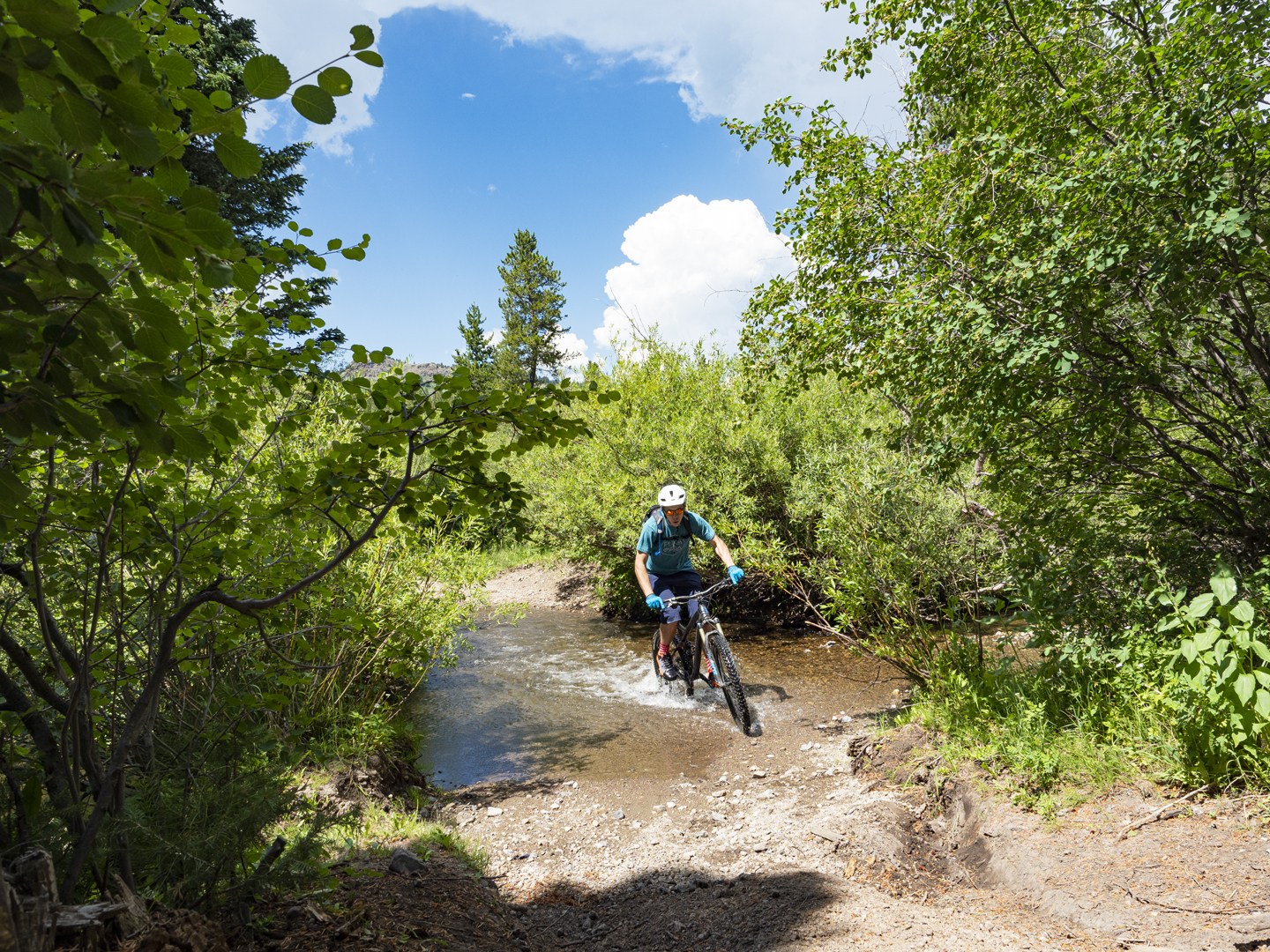
Not a soul in sight. The mellow climb gave us time to soak in the scenery, rolling mountains dotted with aspen groves and the occasional pine, all under a wide open sky. It was one of those rides where you’re just in the zone, enjoying the serenity. Then, in what seemed like out of nowhere, a random road veered off to the right and plunged straight into a river. It didn’t seem like the right move, so we kept pedaling.
About a mile later, we double checked the GPS and map, and sure enough, that was in fact our trail. Looks like it was time to get our feet wet. The cold creek water actually felt amazing as we waded across. On the other side was the official trailhead into the Horseshoe Canyon system.
Three Forks In The Road And We Chose The Toughest
From there, we had three choices. The main trail known as “Burgh”, “Probation” and then something that looked like a road. We took the road. Initially, the climbing was easy, but just a short jaunt up the road it became steeper and steeper. It wasn’t until we summited that we realized it was a four-wheel drive route and not the mountain biking network.
Views Of The Tetons Were Worth It
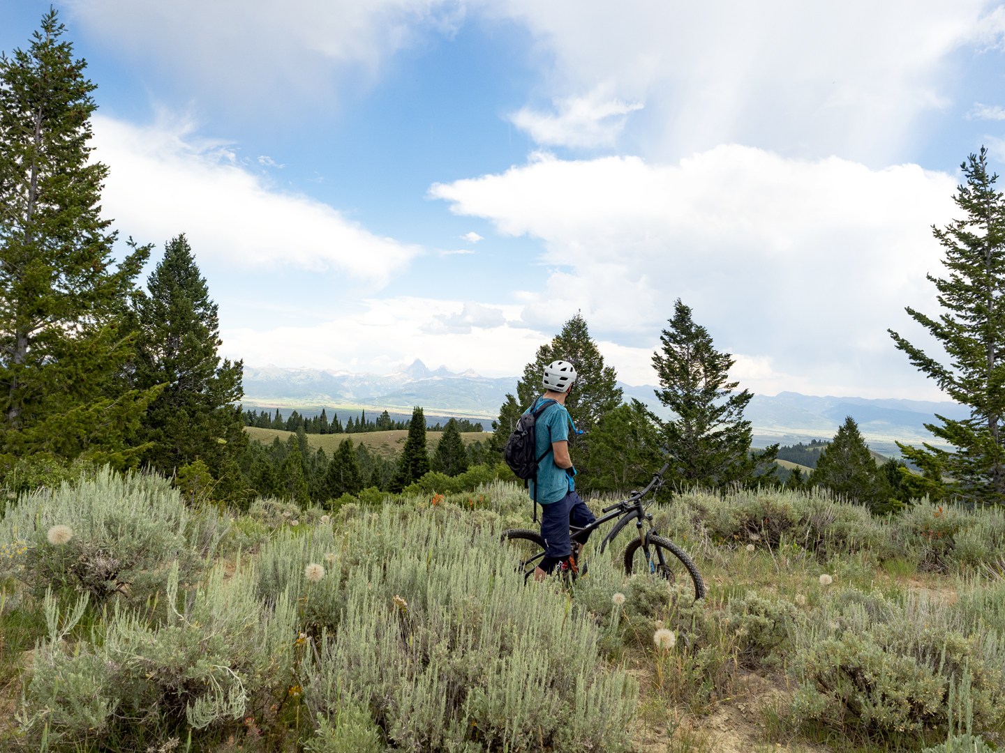
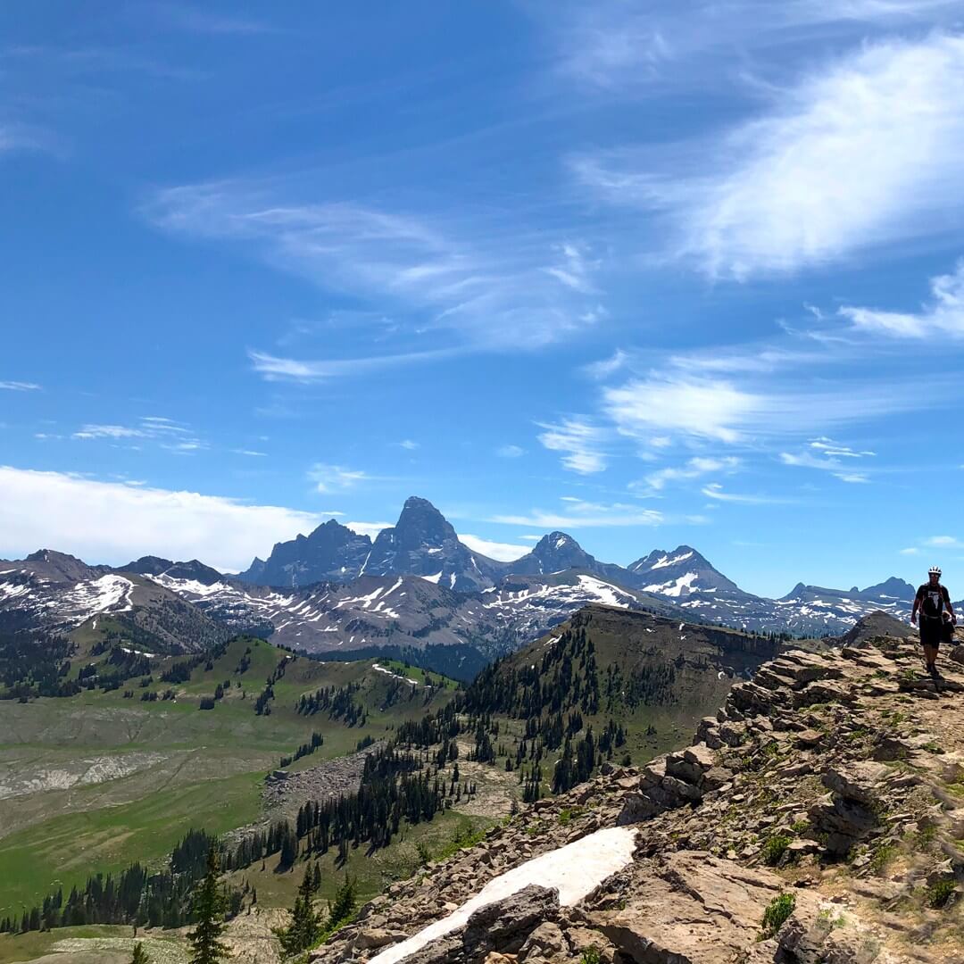
Chewing on a bar to refuel, we gazed across the Teton Valley and the majestic Grand Tetons themselves. With us being the only ones in the area, the feeling was amazing. We knew the bike trails were below us but had no idea where exactly. Following the road down, we finally got to the nexus of the entire system. A sign pointed to each of the singletrack trails. We realized that if we would’ve taken Burgh OR Probation, it would’ve cut off the exhausting trudge up to the summit… but we wouldn’t have seen the views of the Tetons.
Local Freshies® Tip: Follow the trail system not the roads.
Our Favorite Horseshoe Canyon Trails
Shark’s Belly – Fun Of The Rain Forest
Difficulty: Intermediate | Length: 1.5 miles | Climbing 264′ (442′ Descent)
Map & info about Shark’s Belly on Trailforks

Out of our options, we picked Shark’s Belly. The first thing we noticed was how green everything is. The section we had rode earlier featured above-treeline vegetation like granite and pine trees. Shark’s Belly, on the other hand, was bright neon green like a rainforest. The dirt was clay-like and pow-dirt. Tacky as can be. Smooth tight turns that flowed perfectly with only a few pedal strokes to keep you going. A massive grin began to form on my face. It was unbelievable! Like nothing I’d ever ridden before on a mountain biking adventure.
Bovine Bliss – Just Like It Sounds
Difficulty: Intermediate | Length: 1.5 miles | Climbing 58′ (538′ Descent)
Map & info about Bovine Bliss on Trailforks
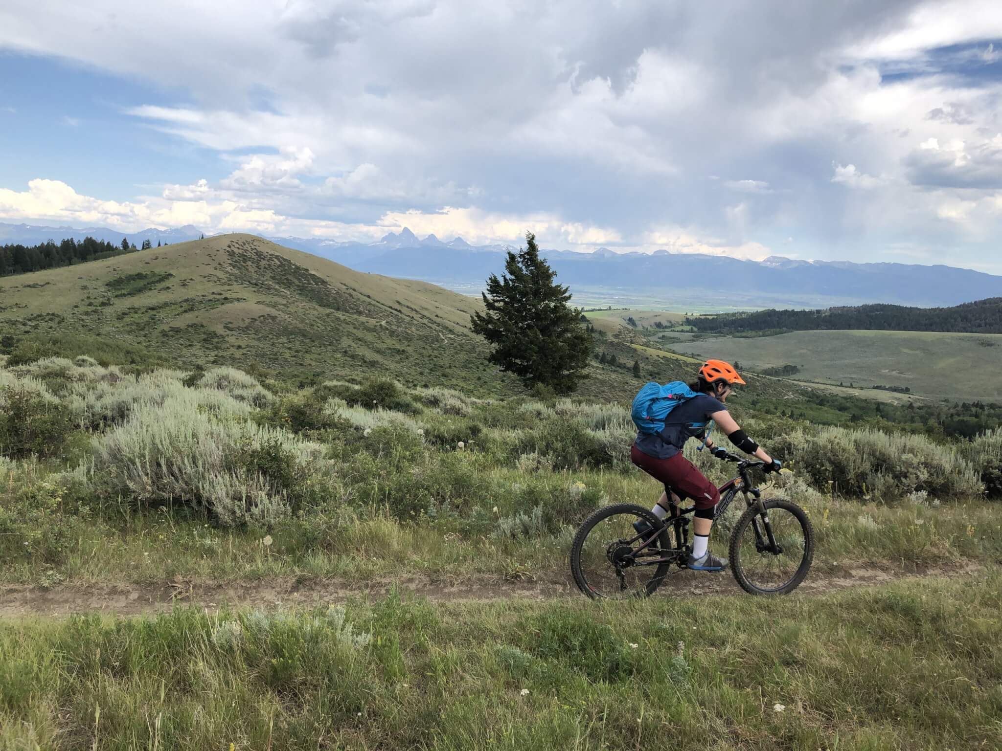
Blasting out of the rainforest-like canopy, we come up to another road intersection. This time we keep going straight and get onto a trail called Bovine Bliss. Now this section was open and more high-desert like. The dirt is still tacky but the huge banked turns whip their way through the sagebrush region until we are dropped onto the main road we’d driven in on.
As we slowly pedal back to the car, we’re flabbergasted at our experience. I’d never ridden a bike through three such distinctly different climates. Sure, there’s alpine and high desert in places but a rain forest too?!? No matter how much people tell you it’s the same everywhere… it isn’t. The air smells different. The dirt composition is distinct. The environment is one-of-a kind. Absolutely enjoy your local trails, but don’t just ride there. Get out of your comfort zone and go for a REAL mountain biking adventure.
Frequently Asked Questions About Horseshoe Canyon Mountain Biking
Is Horseshoe Canyon good for beginners?
Yes, but with a caveat. While the singletrack itself is smooth and forgiving, riders should still be comfortable climbing about 1,500 feet and navigating backcountry trails. It’s an excellent first ride in Teton Valley for beginner-to-intermediate mountain bikers looking to build confidence.
How long does it take to ride Horseshoe Canyon?
Our recommended loop covers roughly 12 miles and typically takes 2 to 4 hours. If you’re the type who likes to keep the pedals turning, you’ll likely finish on the quicker end. But this is one of those rides where it’s worth slowing down. Between the Teton views, quiet forests, and flowing singletrack, there’s plenty to take in along the way.
When is the best time to ride Horseshoe Canyon?
The best riding is typically from late spring through fall, with summer offering Teton Valley’s famous tacky dirt and comfortable mountain temperatures. Always check current trail conditions with Mountain Bike the Tetons before heading out.
Are there bears in Horseshoe Canyon?
Yes. Horseshoe Canyon is bear country, with black bears being the species you’re most likely to encounter. Grizzly bears are much rarer, although the first confirmed grizzly sighting in the Big Hole Mountains occurred in 2016. We always recommend carrying bear spray, making noise while riding, and staying aware of your surroundings.
Is there water or a restroom at the trailhead?
No. The Nickerson Grove Trailhead has no potable water or restrooms. Bring plenty of water before you start. If you’re carrying a water filter, you can refill from the creek roughly halfway through the ride.
Is there cell service?
No. Once you leave the trailhead, you should expect little to no cell service. Download offline maps before your ride and let someone know your plans.
Is parking free?
Yes. Parking at the Nickerson Grove Trailhead is free, but there are only a handful of parking spaces available.
Can I ride Horseshoe Canyon as a shuttle?
While some riders use portions of the network as part of larger rides, we think Horseshoe Canyon is best experienced as a loop. Connecting the trails lets you enjoy nearly everything the network has to offer, from scenic climbs to flowing descents.