When the word “Taos” is uttered, there’s usually two things that come to mind: skiing and art. While this is true, another thing that’s beginning to register on the radar for this region: mountain biking. Taos MTB is an opportunity to experience the unique culture of this region AND get a dose of that adrenaline all mountain bikers need. Here’s a list of some of the most popular trails that every off-road cycling traveler should put on their checklist when visiting.
A Rounded Vacation Destination
Before you delve into Taos MTB, one thing you need to think about for any mountain biking destination is what else is there to do? Sure, riding on two wheels is fun but you need to have some leisure time too. The town of Taos and the surrounding region has SOOOO much more to offer beyond the singletrack. You’ll find culture older than the United States, unique cuisine, and amazing scenery. We suggest checking out our Taos guide to get a closer look:
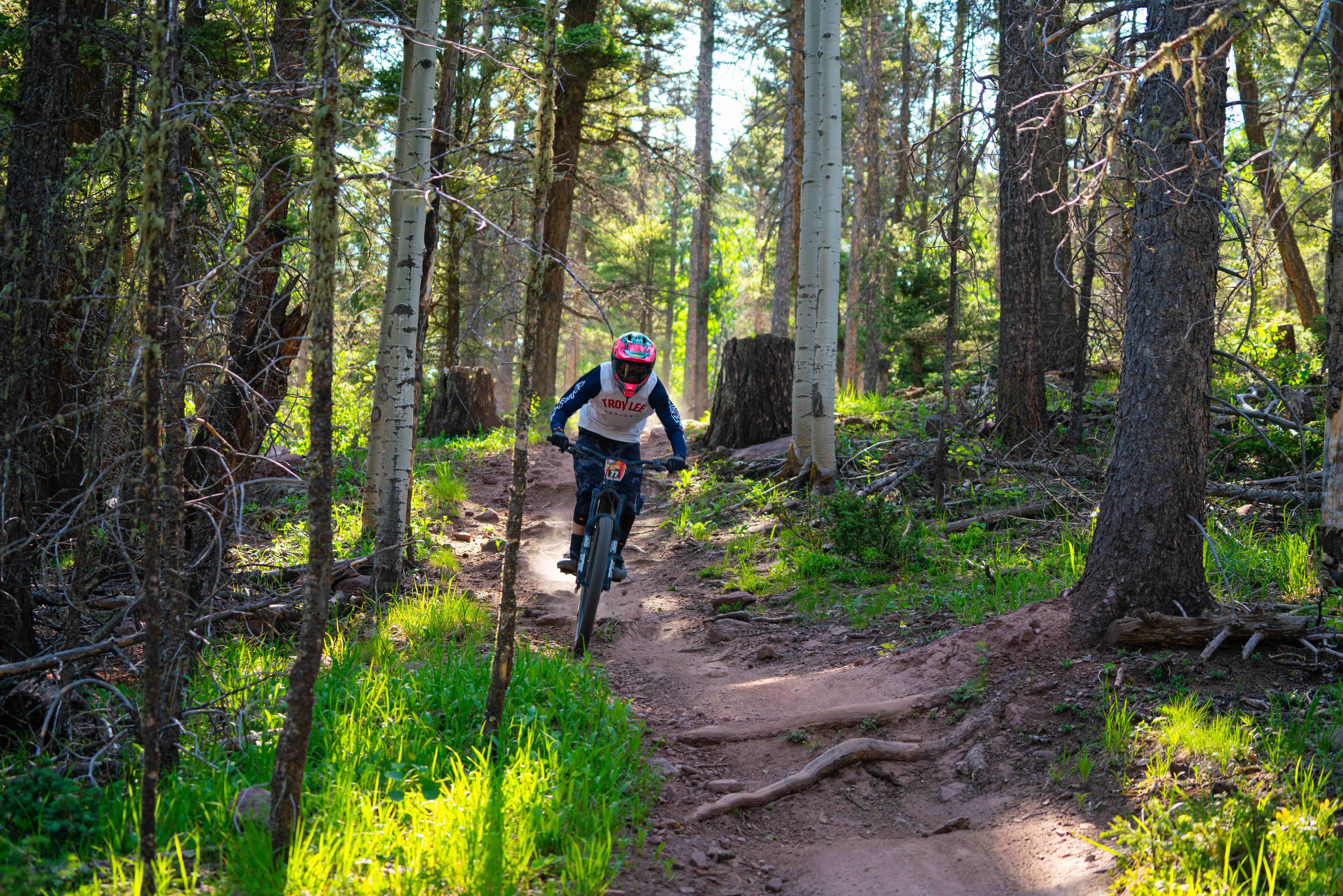
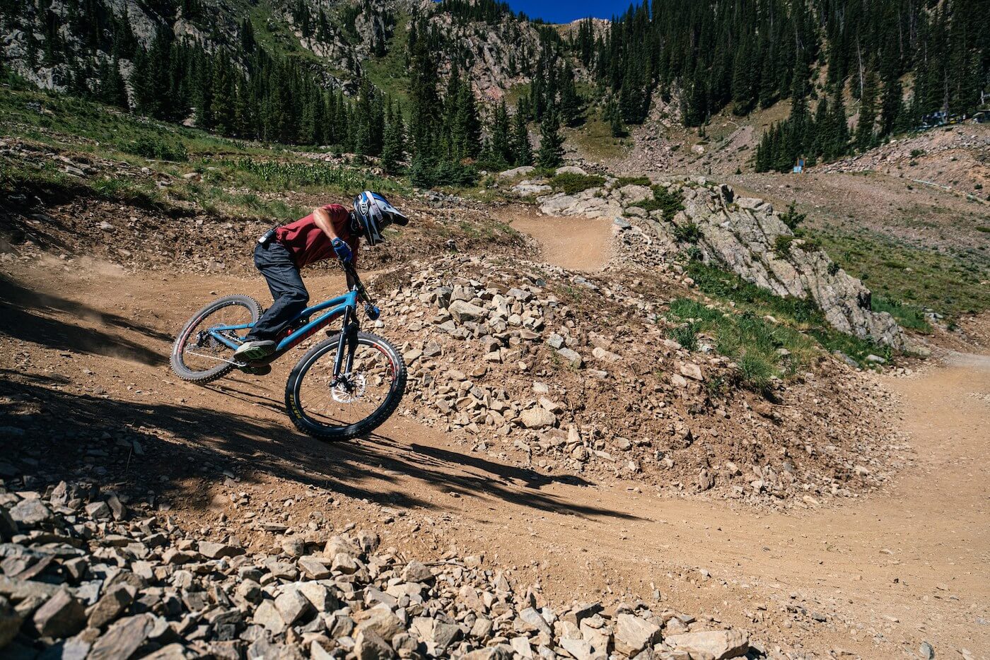
Angel Fire Bike Park
Miles of Trails: 60+ miles | Number of Trails: 32 | Vertical Relief: 2,000 feet – Trailforks
You’d think with most of New Mexico being high desert, the dirt and weather would be pretty much the same everywhere. Nope. Not even close. Angel Fire is a whole different beast—and that’s a good thing.
Tucked up in the southern Rockies, Angel Fire hits the jackpot when it comes to natural terrain and weather. But what really sets it apart? It’s not on U.S. Forest Service land. That’s huge. Most bike parks have to jump through endless hoops to build or maintain trails. Angel Fire? Being on private land means they can go full throttle on trail building, dialing in features and flow you just won’t find at most spots.
When Angel Fire says 60+ miles of legit downhill and 2,000 feet of vertical, they’re not messing around. This isn’t one of those mountains that throws out big mileage stats, only to deliver a few real descents and a bunch of filler. At Angel Fire, every mile is the real deal—fast, raw, chunky tech that’s built to shred. It’s not just the top bike park in the Southwest—or even the U.S. Some would argue it’s one of the best in all of North America.
The Dirt
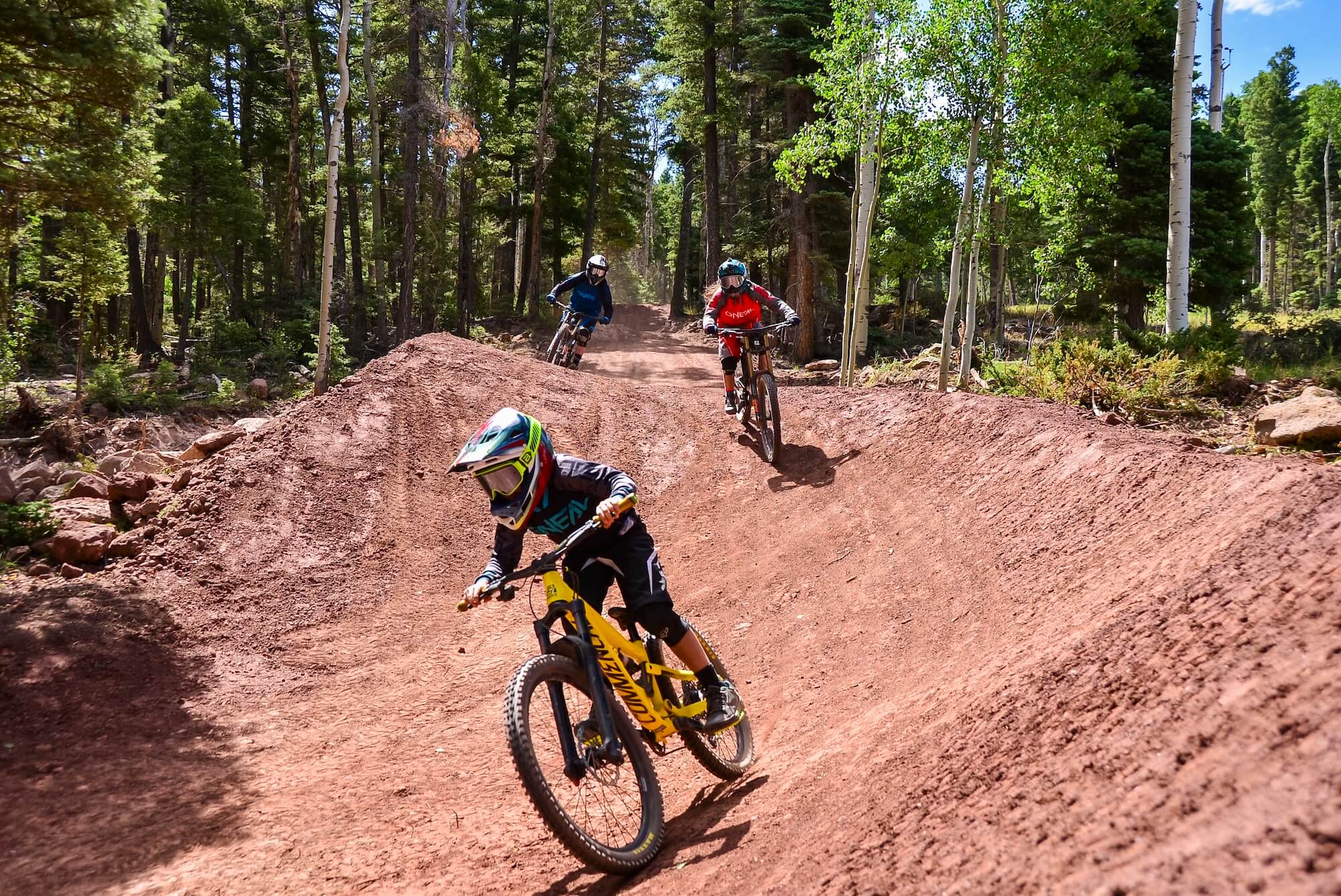
For starters, while other parts of the state feature sandy, rocky, or loose gravel, Angel Fire is home to clay, making for tacky goodness. Alongside this clay, it’s still sprinkled with enough rocks, boulders, and steeps to keep even the gnarliest rider happy.
The Weather
As the days of summer get longer, most of the western United States’ singletrack is getting baked. What many call this type of condition is “moon dust.” Dusty doesn’t even begin to describe a lot of trails. But not at Angel Fire. Yet again, this place is gifted with occasional afternoon thunderstorms to keep the soil moist throughout the season.
Something For Everyone
The secret is out – Angel Fire’s bike park is home to technical terrain to tackle. It’s been the host of many pro races including a World Cup showcase. What many don’t realize is that it offers something for everyone. This isn’t Downieville or Whistler where you keep the kiddos at home and charge it full bore. It’s designed to bring and entertain the ENTIRE family. Of course, it still has scare your pants off goodness but it also has a host of smooth as a baby’s bottom flowy descents that you’ll get your kids hooked on riding.
South Boundary Trail
Difficulty: Intermediate (3 miles of technical segments that can be walked around ) / Advanced
Distance: 20 miles | Climbing: 1,147 Feet | Descent: 4,511 Feet
Map & info about South Boundary on Trailforks
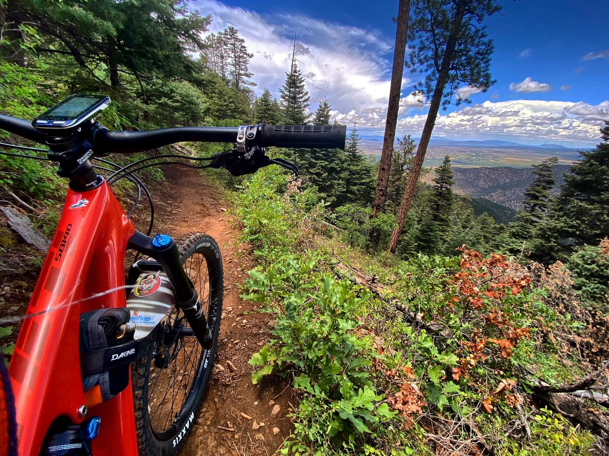
This is THE Taos MTB singletrack that everyone must ride. Located within the Carson National Forest, most people start near Angel Fire Resort. The 20+ mile point-to-point ride is like a close up tour of the Sangre de Cristo Mountains. It literally has a bit of everything. A sweeping flowy section through evergreens and aspen groves nicknamed “Heaven on Earth.” A few climbs such as the 1.5-mile 350 ft ascent to Garcia Peak. And to finish it off properly, the most technical sections are within the last three miles. Known as El Nogal, expect some fast sections. Some stair-steppy segments. Some fun parts… and even a few terrifying ones.
Things To Know
Most do this ride as a shuttle starting near Angel Fire. This provides smoother ascents and more downhill segments. An intermediate can tackle most of the trail as long as you’re ok with walking a few of the tricky obstacles at the end. It’s a great add-on to the lift-accessed goodness at Angel Fire Bike Park. Shuttle Taos is the go-to professional MTB shuttle service for South Boundary. They’ll get you to the prime drop zone so you can focus on shredding the best descent in New Mexico with just enough climbing to keep things interesting.
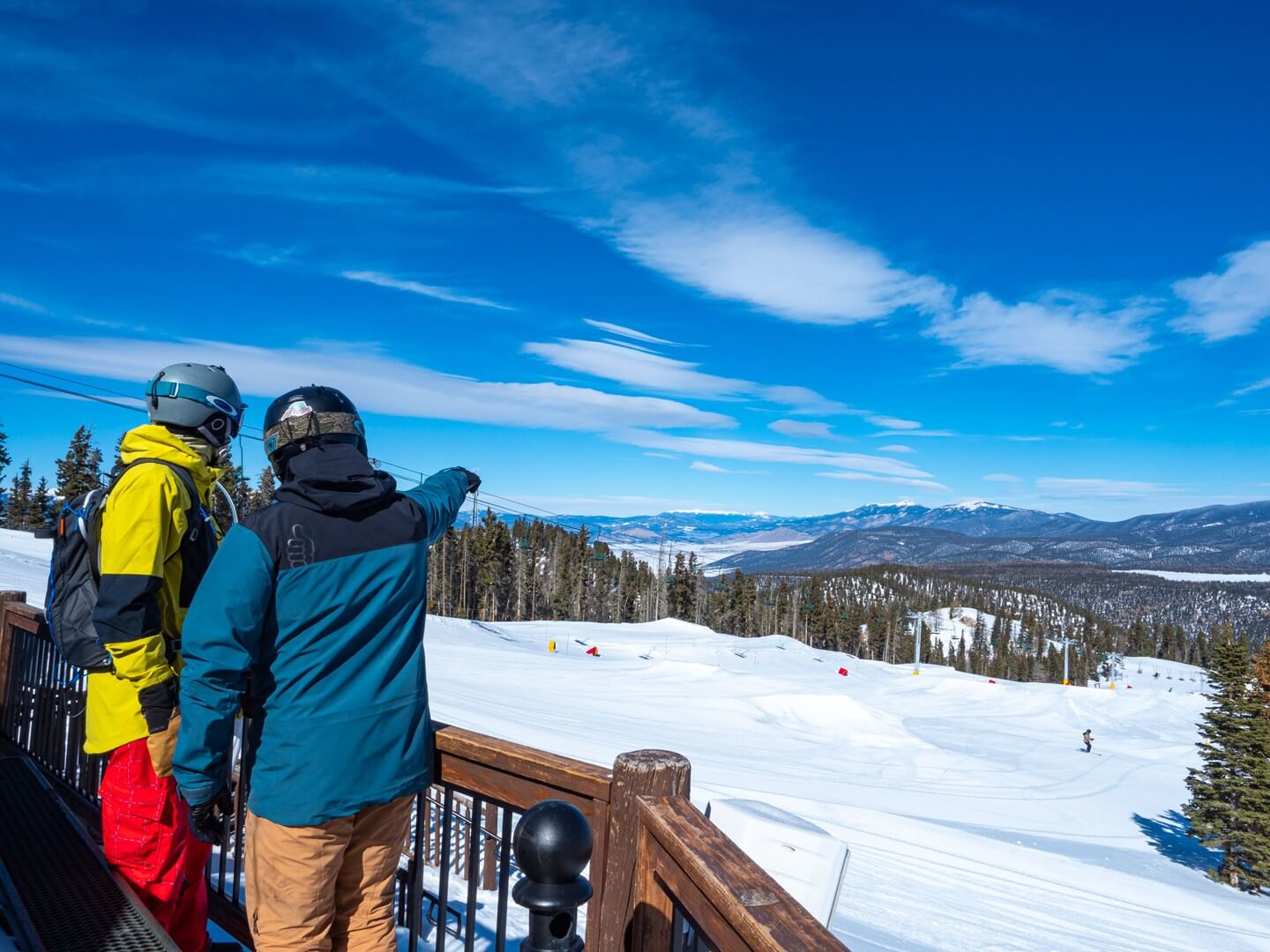
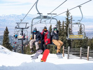
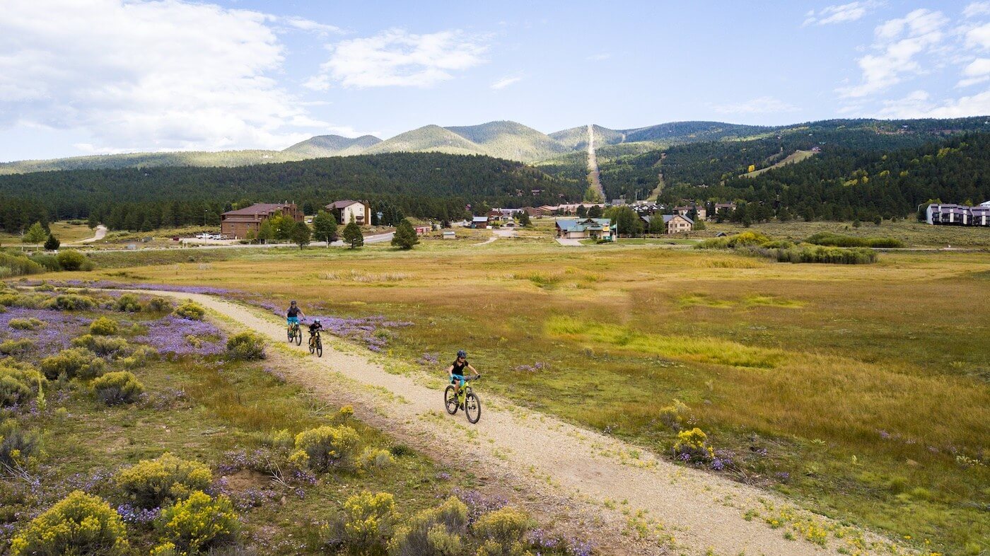
Taos Ski Valley
Miles of Trails: 11 miles | Number of Trails: 12 | Vertical Relief: 1,900+ feet – Trailforks
As you ascend from the town of Taos, for some reason the peaks look bigger without their snowy blanket. Cliffs suddenly become more pronounced. The legendary chutes of Taos look less like something you’d ski and more something you’d rappel. So, what is there to do in TSV during the summer? As part of their multi-million-dollar investment, since summer 2021, the Taos MTB scene has become a reality.
Green Chile
Cuisine in New Mexico is its own thing. And one of the key ingredients for almost all New Mexican dishes is green or red chiles. As such, it makes sense that the first lift-accessed trail to be introduced in the Taos Bike Park was named just that. Not tongue burning like a ghost pepper, but spicy enough to awaken your senses. To keep with the local food theme, they also opened up an intermediate trail called Blue Corn. This one starts with some nice tight berms and features a long curved bridge finishing off with some bumps and tables.
Fun For The Whole Family
While Taos might be known for its blood-pumping steeps, the goal of the Green Chile Flow Trail is to create something so everyone can get a taste of the Taos MTB scene. The four-mile downhill trail features perfectly contoured banked turns. Fantastic scenery abounds, and of course once you’re done, you can enjoy a cold one at the Bavarian. Now that’s how you do summer! Not enough? They also installed a Via Ferrata course!
Northside
Miles of Trails: 18 miles | Vertical Relief: 2,800+ feet – Trailforks
Note: The trail system is closed for the first part of the 2025 summer season due to ongoing forestry and fire thinning work.
Check Status here: Ride Northside at Taos
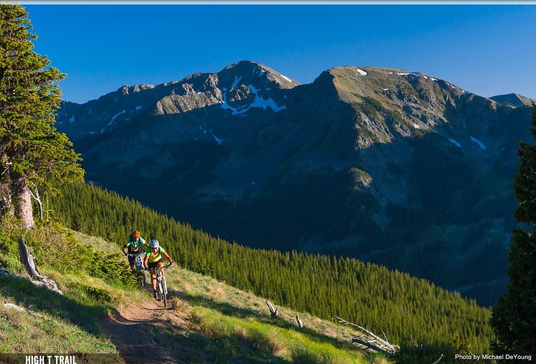
Just across the street from Taos Ski Valley resort is the Northside. Not just one trail, but an entire Taos MTB network to explore. Starting at 10,000 feet, get ready for a lung burner. Within the 1,200 acres, you’ll find both single and double track routes. Spectacular overlooks. Wildflowers. Sub-alpine and alpine environments and up to 2,800 vertical feet of climbing including to the top of Frazer Mountain. Think less purpose-built and more classic tours with downhills worth the climb.
Things To Know
Free access to Northside at Taos Ski Valley is available either online by signing a liability waiver at the Ride Northside website or available at the Bull of The Woods entrance kiosk at Northside. DON’T FORGET YOUR CAMERA!!!! Be aware that parts of the national forest in this area may be closed to all visitors due to fire mitigation work. As fire season rolls around every year, there’s always serious work to do to keep it safe for all of us. For the latest alerts, be sure to visit the US Forest Service Homepage.
Lost Lake Loop
Difficulty: Advanced
Distance: 13.3 miles | Climbing: 2,279 Feet | Descent: 2,268 Feet
Map & info about Lost Lake Loop on Trailforks
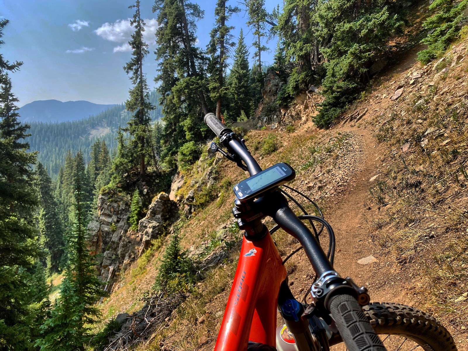
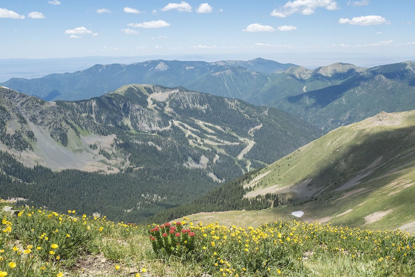
As part of your Taos MTB tour, you’ll want to set aside a day to check out the Enchanted Circle Highway. The 84-mile scenic byway circles the tallest peak in the Sangre De Cristo Mountains – Wheeler Peak and dives into the towns that surround it including the unique town of Red River. From there, you can access the Lost Lake Loop. The nearly 14-mile loop is one of the only above alpine trails in the state. Not for the faint of heart, the higher sections of this trail have exposure, rocks and cliffs, and talus slopes to navigate. What you do get as a reward are ripping descents and epic views of the Sangre de Cristo mountains and valleys around Red River.
Things To Know
As we stated above, this trail is in the high alpine meaning a few things. On average the trail is covered in snow from October through mid-June or later in heavy snow years. Check the forecast ahead of time since the open rock fields can attract lightning. And if visiting later in the season, there are sections that go through steep avalanche terrain you may need to be concerned about if there is snow above.
For Beginners
If these seem a bit daunting, there’s plenty of lesser aggressive trails to sample the beauty of the area and get off the beaten path. We’ve heard the West Rim of The Rio Grande offers fantastic scenery of the Sangre de Cristo range in a very relaxed environment. If you want to ratchet it up a bit for some true singletrack, head to the Taos Valley Overlook trails. It features a few climbs and a bit of tight and twisty turns to give you a taste of what mountain biking is all about.
After our trip a few winters ago and hearing from the locals about just how good the cycling is, it has our mouths watering for some green and red chiles AND some mountain biking in the Southwest.